| Location | Havasupai, Arizona | |
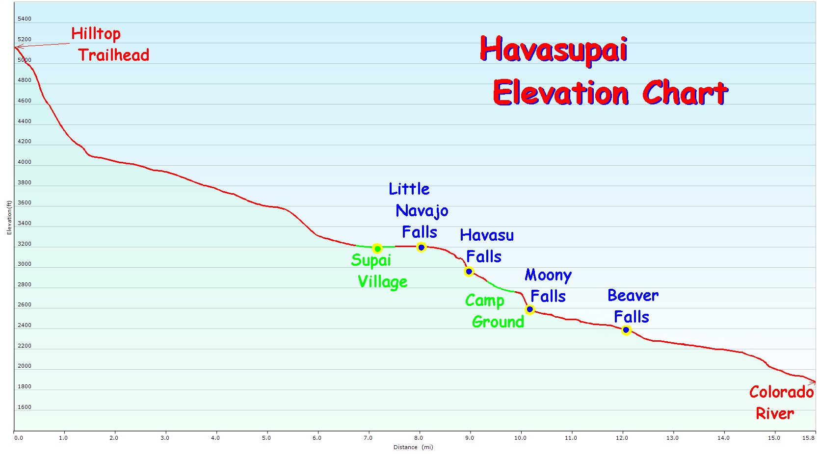
| Elevation | Trailhead | 5,180 ft |
| Supai Village | 3,200 ft | |
| Campground | 2,720 ft |
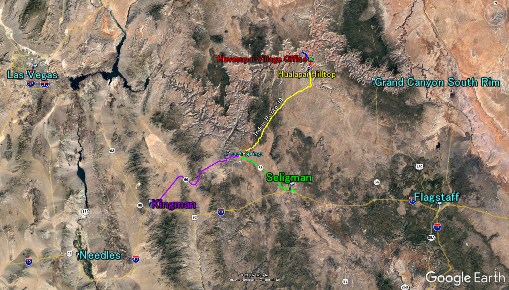
| From Las Vegas | 220 mile | about 4 hours | |
| From Los Angeles | 440 mile | about 7.5 - 8 hours | |
| From Flagstaff | 165 mile | about 2.5 - 3 hours | |
| From Phoenix | 260 mile | about 4.5 - 5 hours |

| Purple Line | Histric Route 66 : via Kingman | 54 mile | ||
| Green Line | Histric Route 66 : via Seligman | 30 mile | ||
| Yellow Line | Indian Route 18 | 60 mile | ||
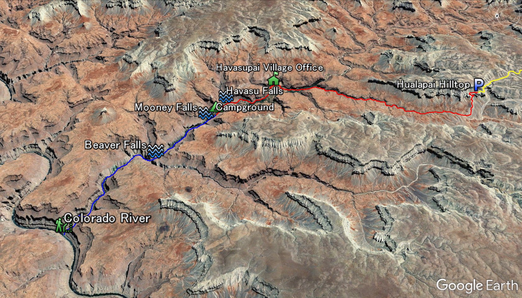
| Red Line | Havasupai Trail : Hilltop - Campground | 9.5 mile | ||
| Blue Line | Colorado River Trail : Campground - Colorado River | 6.5 mile |
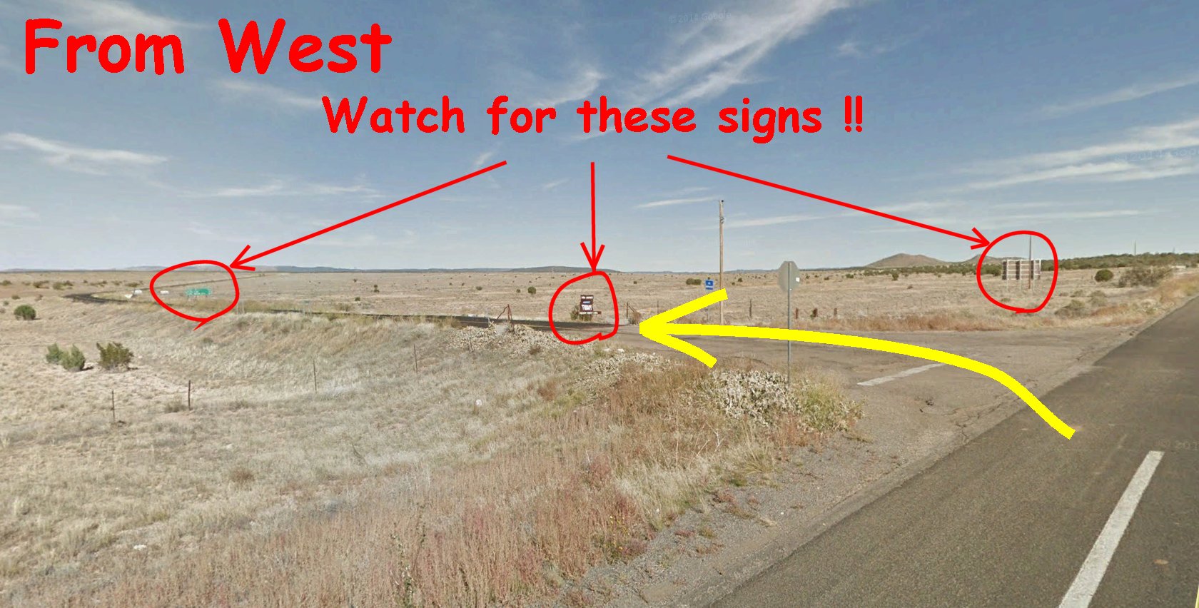
Coming From West via Kingman (coming from Los Angeles, Las Vegas etc...)
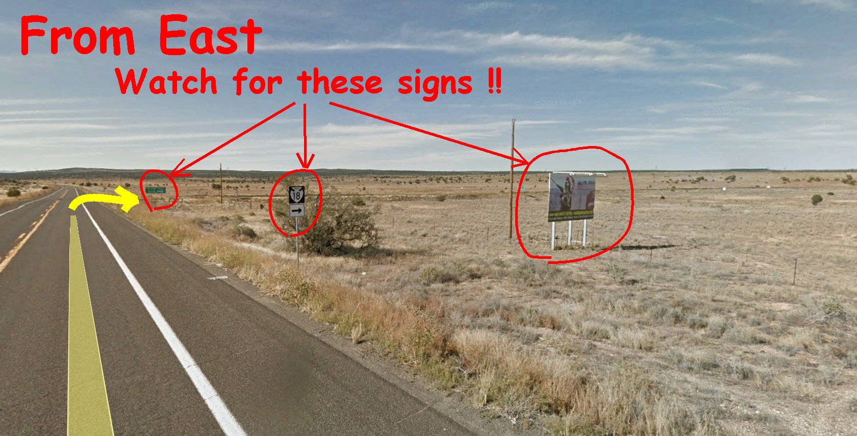
Coming From East via Seligman (coming from Phoenix, Flagstaff etc...)
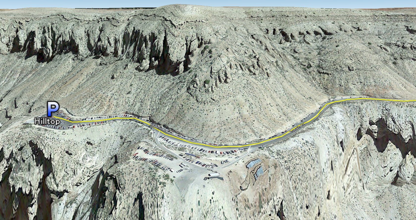
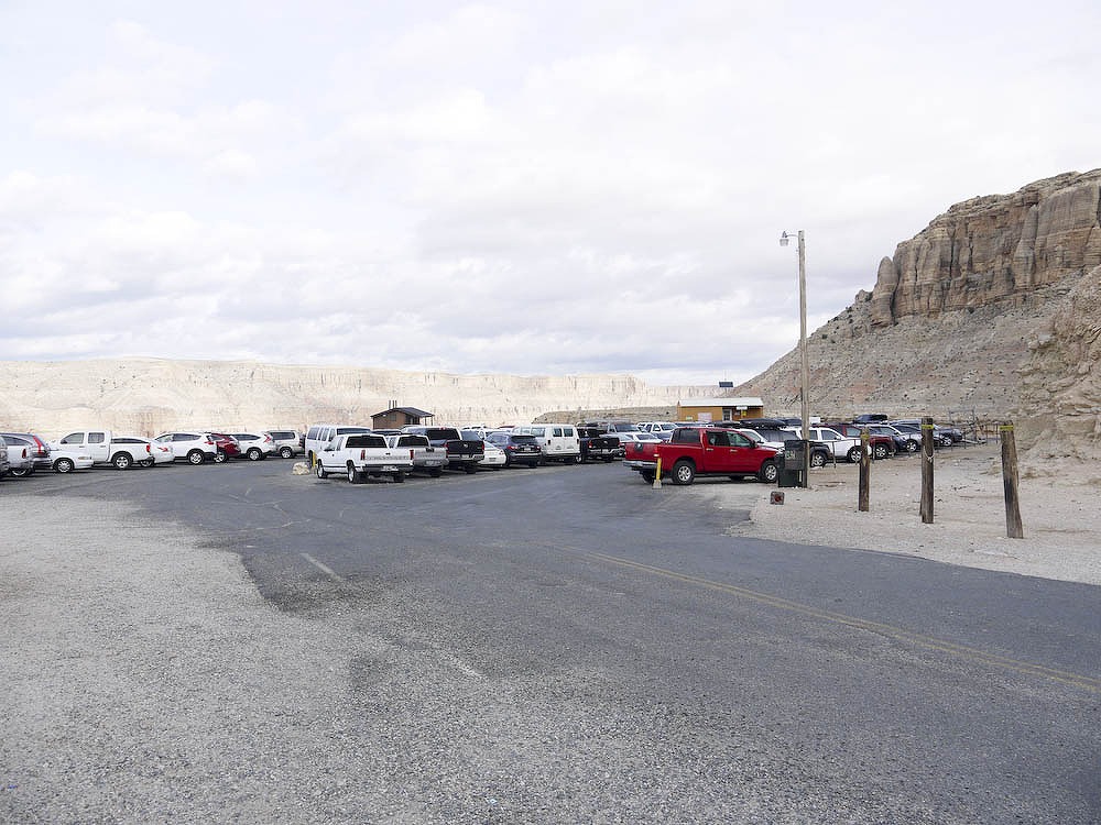
Hualapai Hilltop Parking lot / Havasupai Trailhead
|
| From Trailhead | Distance | Elevation change |
| Supai Village office | 7.5 mile | -2,000 ft |
| Camp Ground | 9.5 mile | -2,400 ft |
| From Campground | Distance | Elevation change |
| Supai Village office | 2 mile | +400 ft |
| Havasu Falls | 0.5 mile | +150 ft |
| Moony Falls | 0.5 mile | -200 ft |
| Beaver Falls | 2.5 mile | -400 ft |
| Colorado River | 6.5 mile | -900 ft |
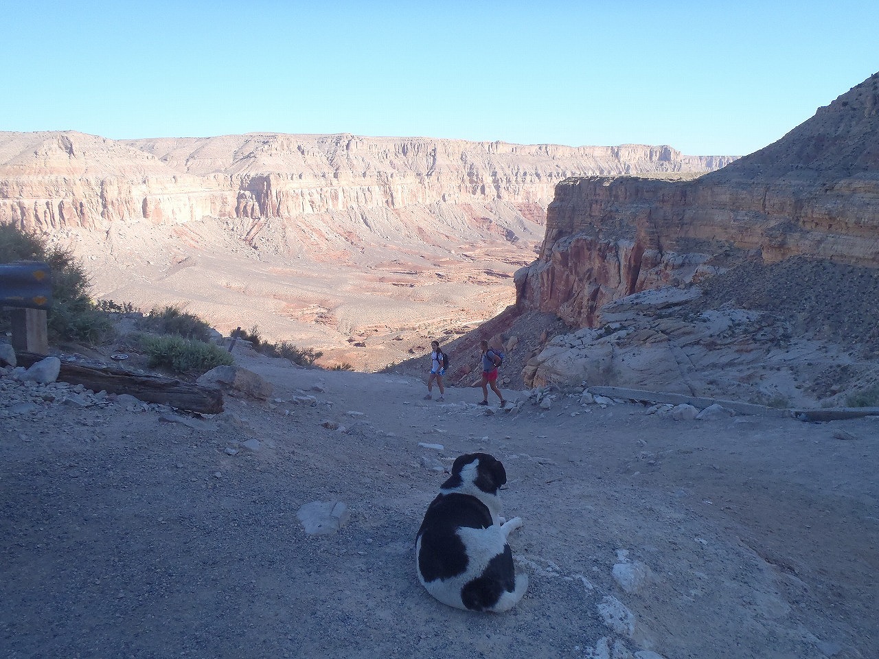
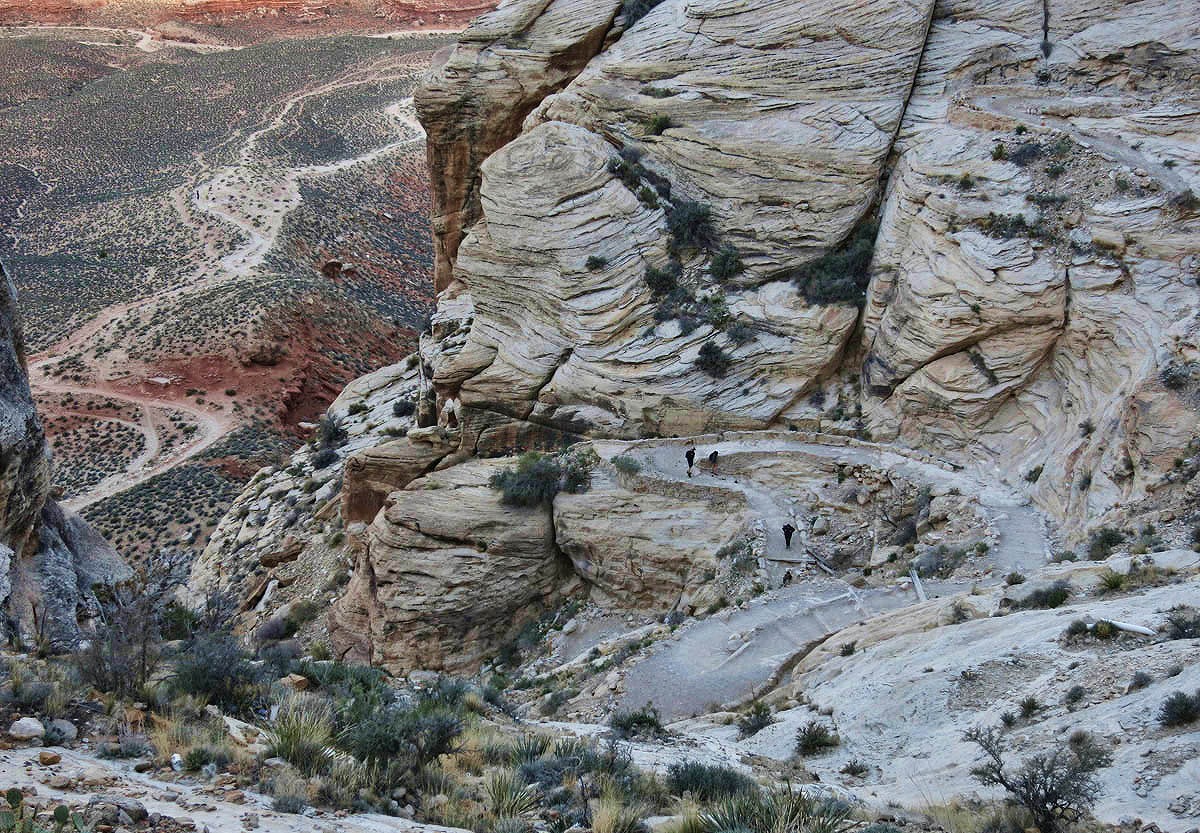
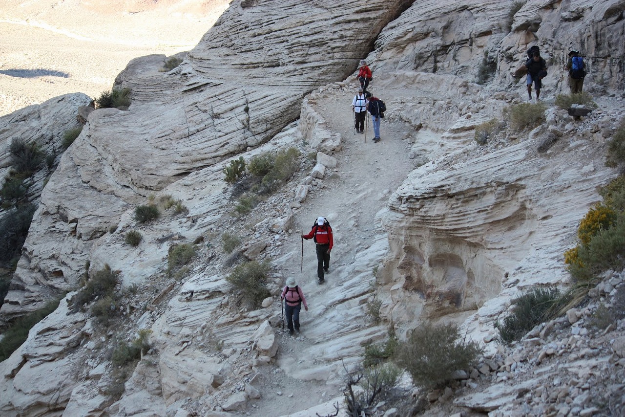
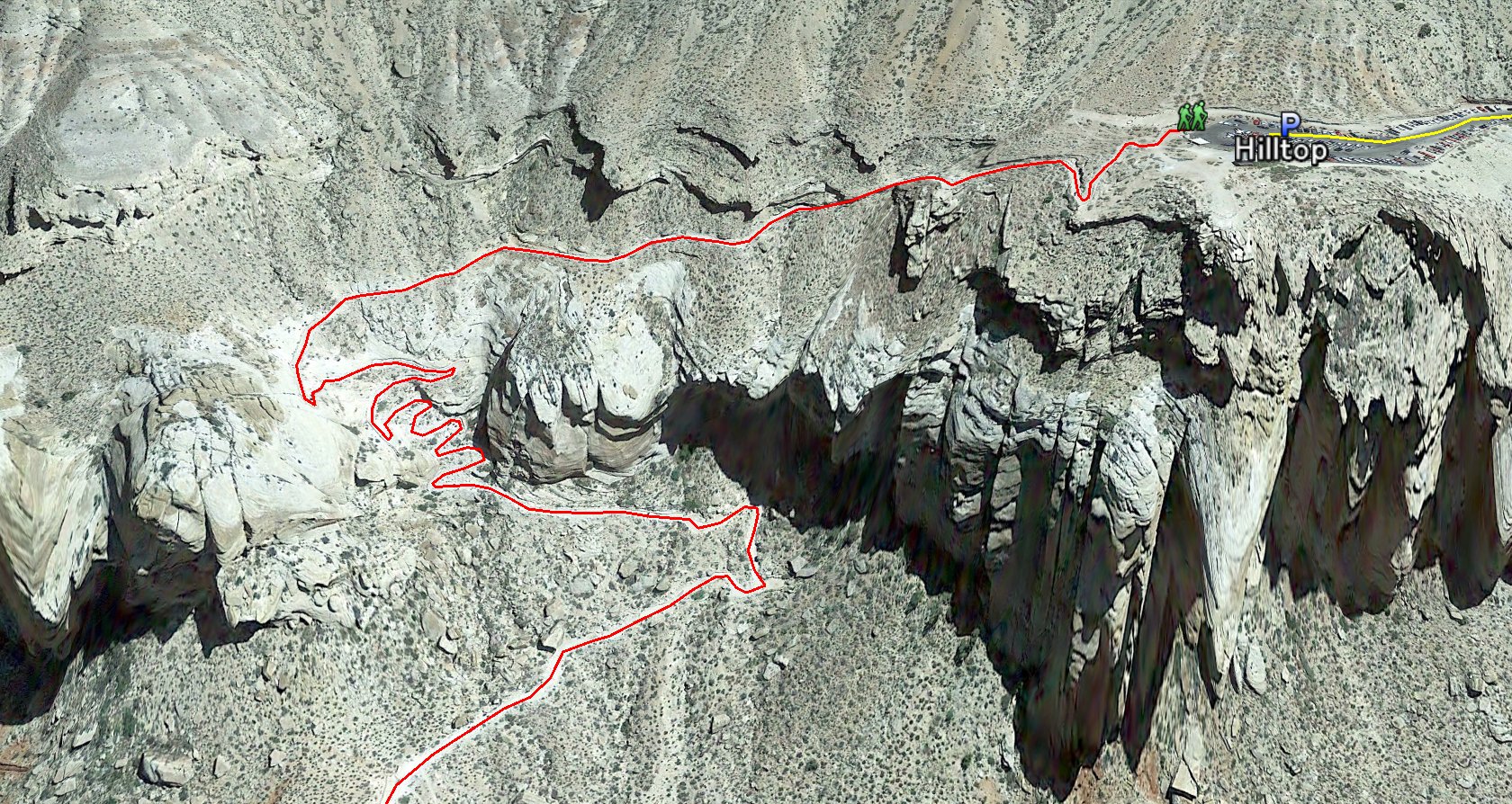 The Trailhead is the Northend of Parking lot. (near the Restroom) From the trailhead, the trail goes down the side of canyon wall for 1.5 miles to the bottom of the canyon. This part is moderately steep and there are lots of switchbacks.
|
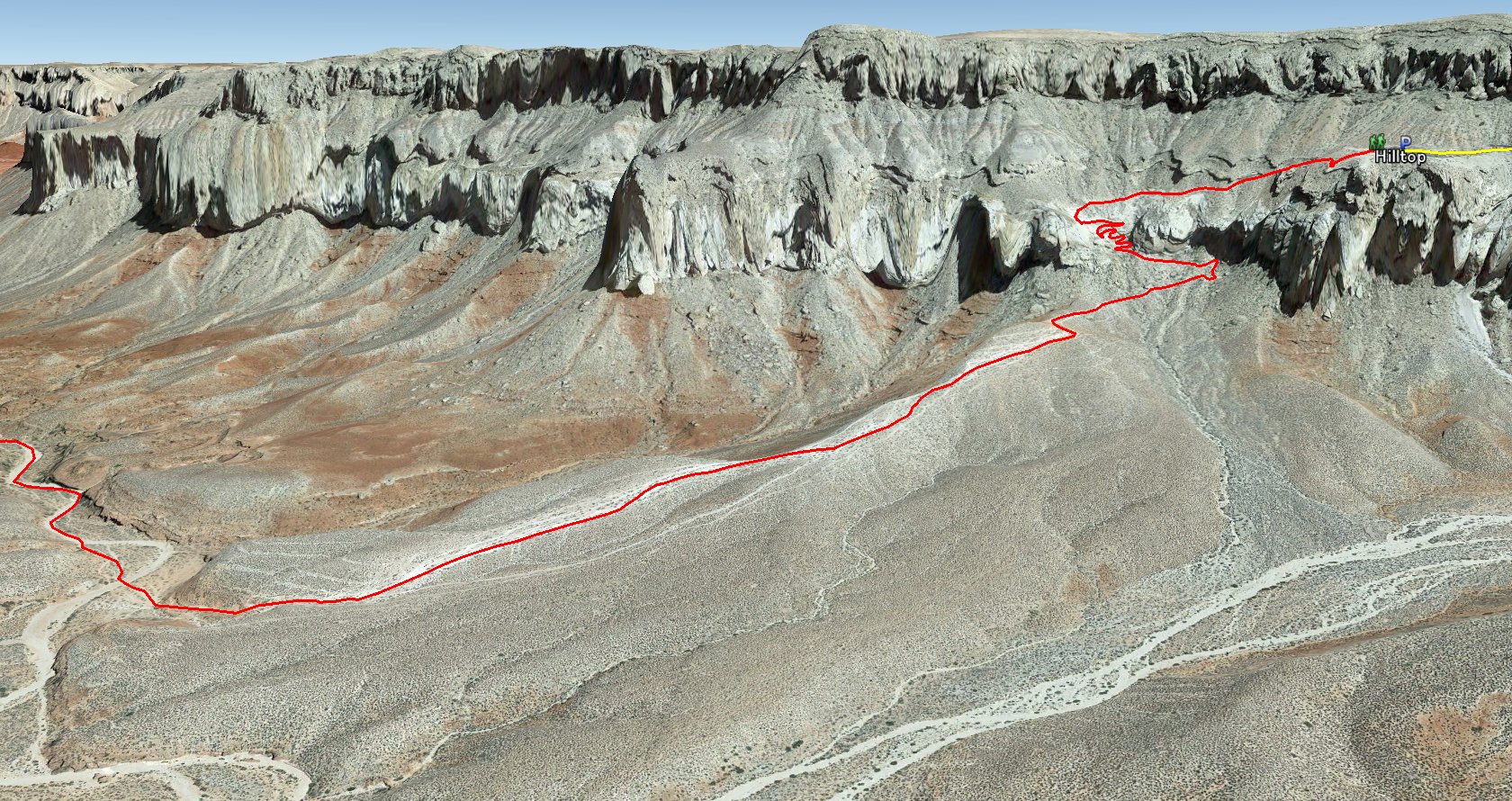 After the first half mile of switchback section, the trail kept going down for another mile to the bottom of the canyon.
|
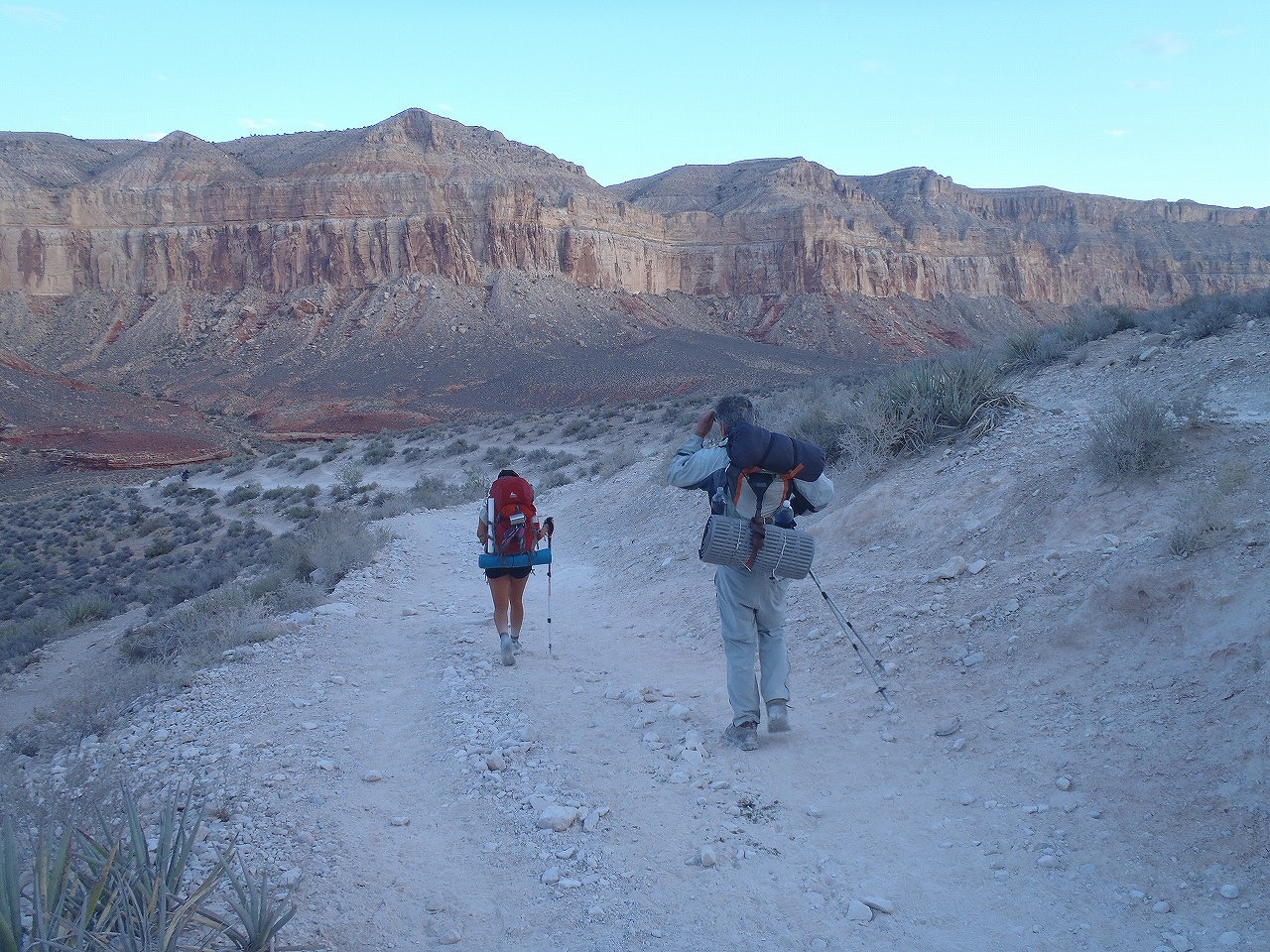
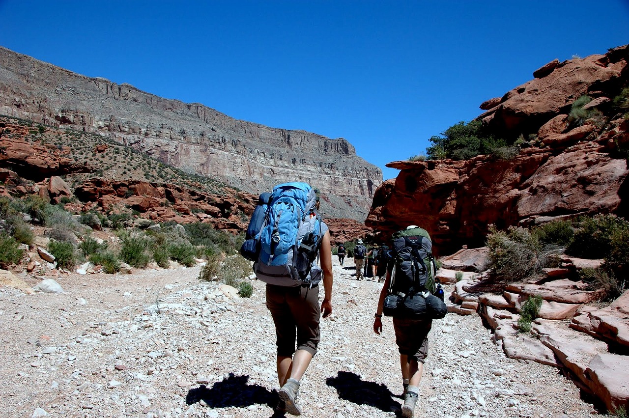
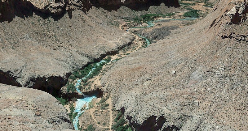
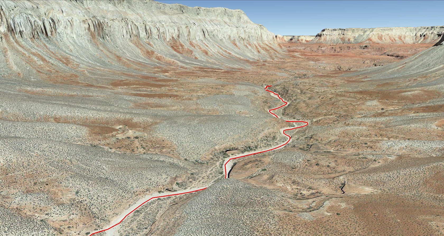 Once the trail comes down to the bottom of the canyon, it starts following the dry wash at the bottom of the canyon. This dry wash is couple hundred feet wide. There are NO Sun shade at this point for next 2.5 miles.
|
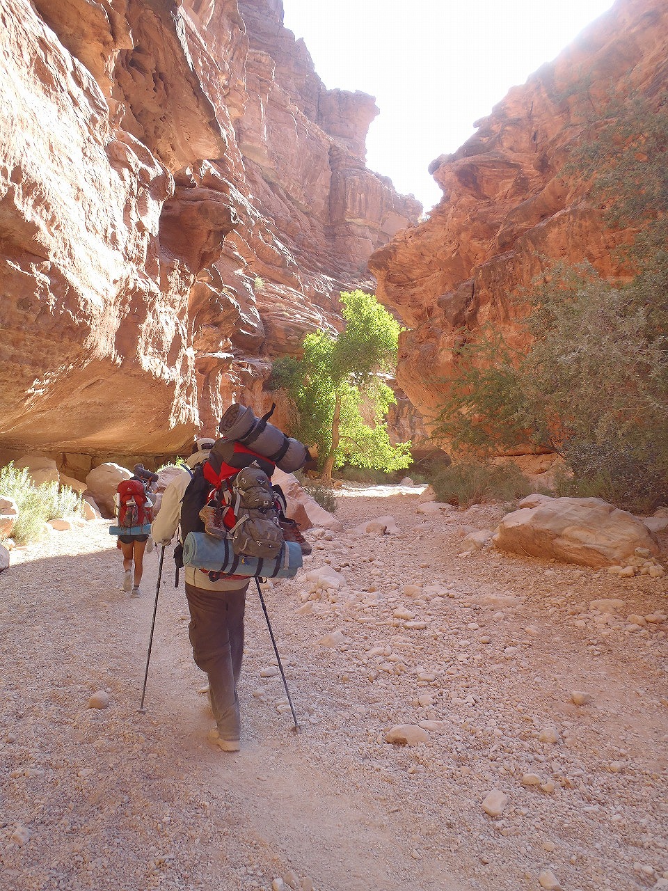
 This wash getting narrower (50 - 100 ft) and deeper (couple hundred ft). You can get some sun shade at few sections for next 2 mile. The scenery gets nicer and nicer !
|
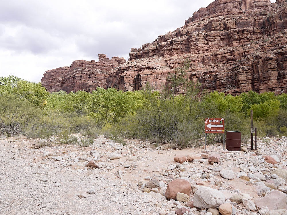
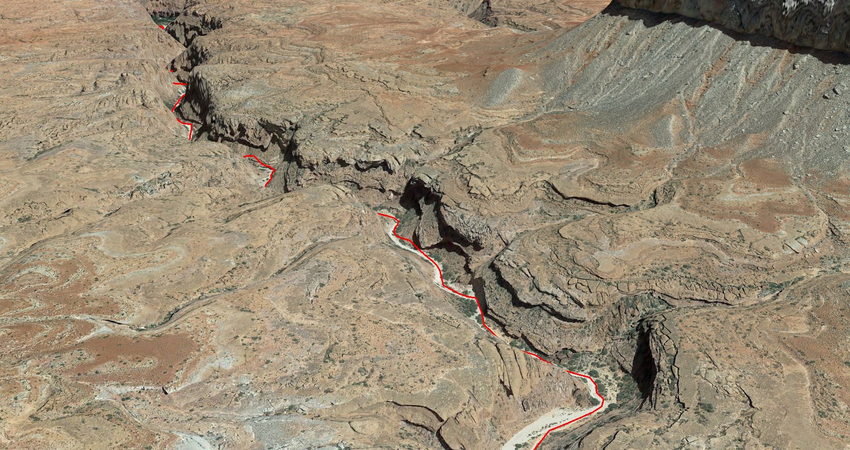
 All of the sudden the canyon opens up. You may see Supai sign. Now, you are in the Havasupai indian reservation. Yet, there is another 1.5 miles to the Havasupai village tourist office.
|
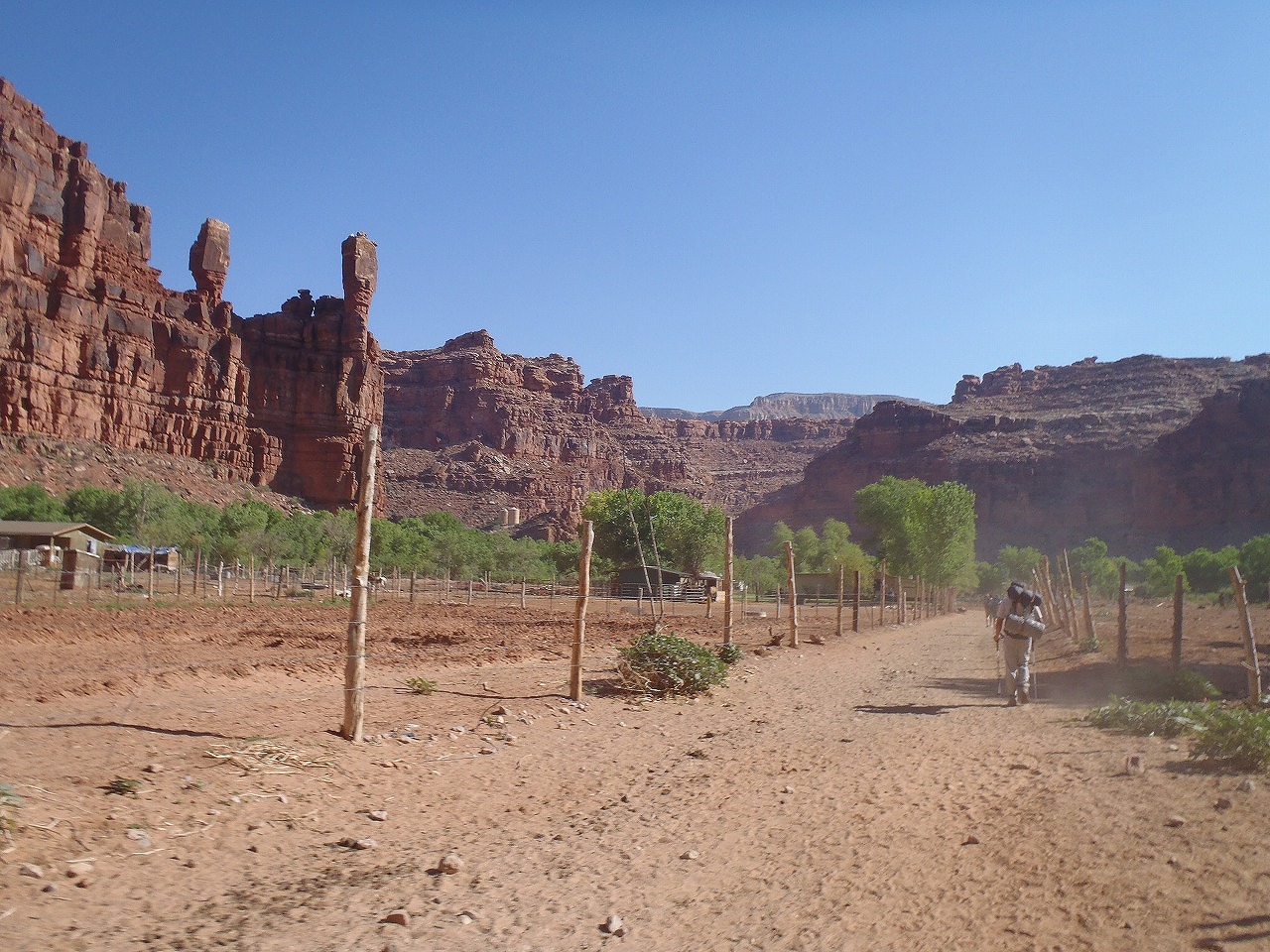
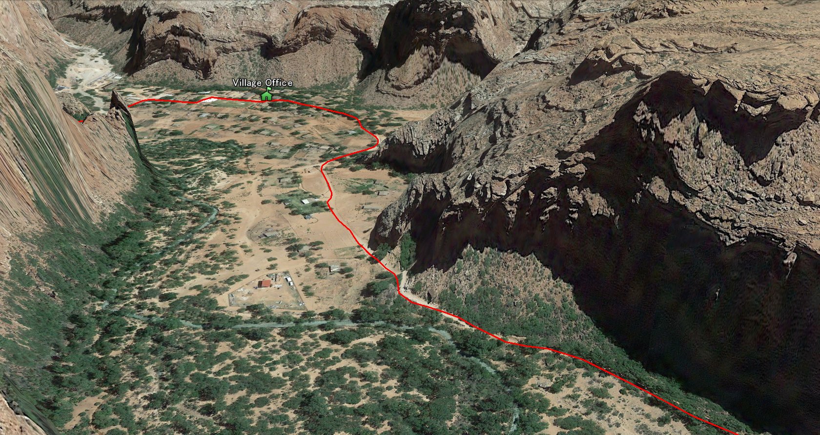 You will start seeing houses and horse/cow stables. At this part, the narrow trail turns to wide dart road. Follow the road and it turns to the right at the end of big horse stable then it turns to the left.
|
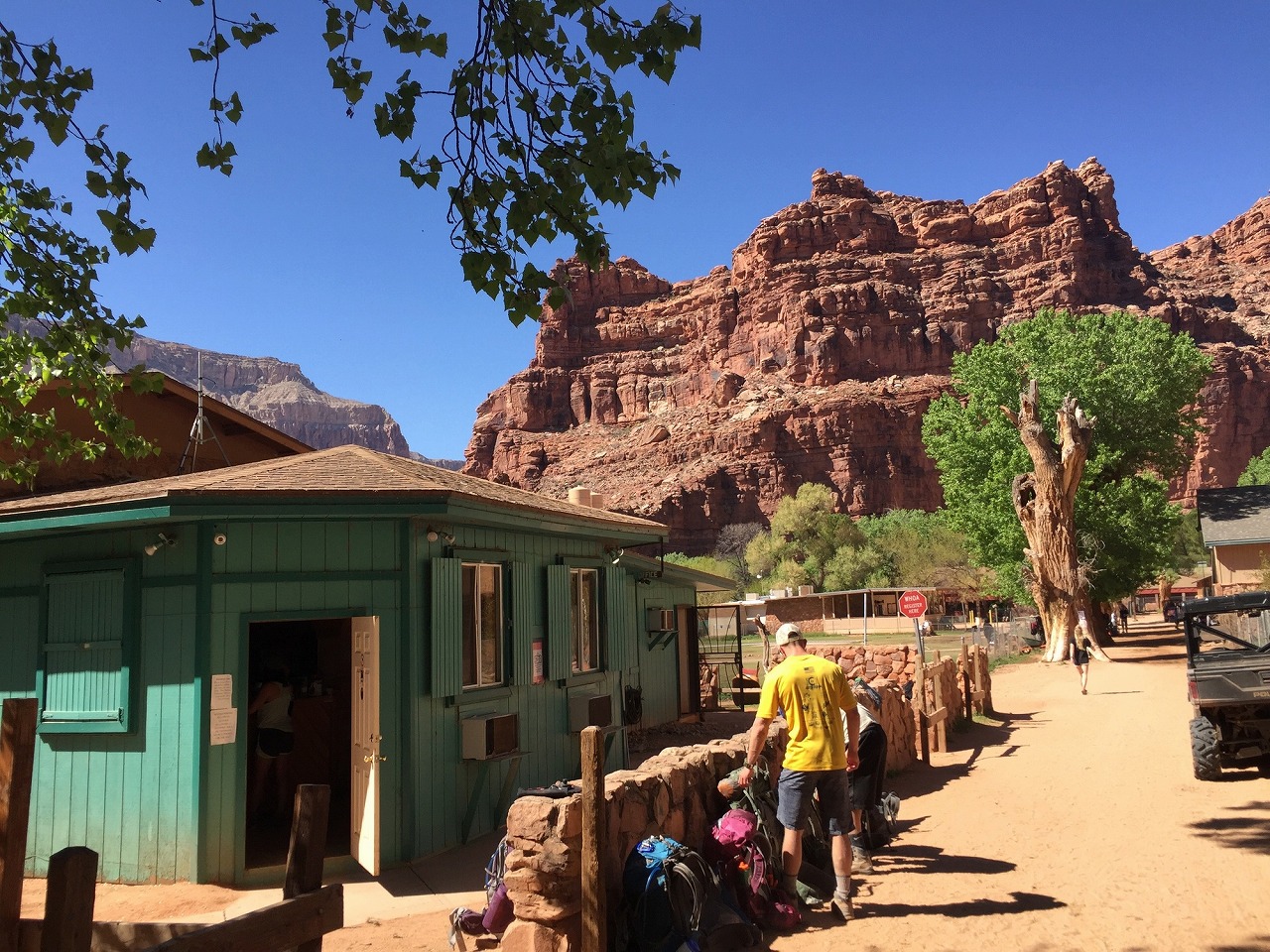
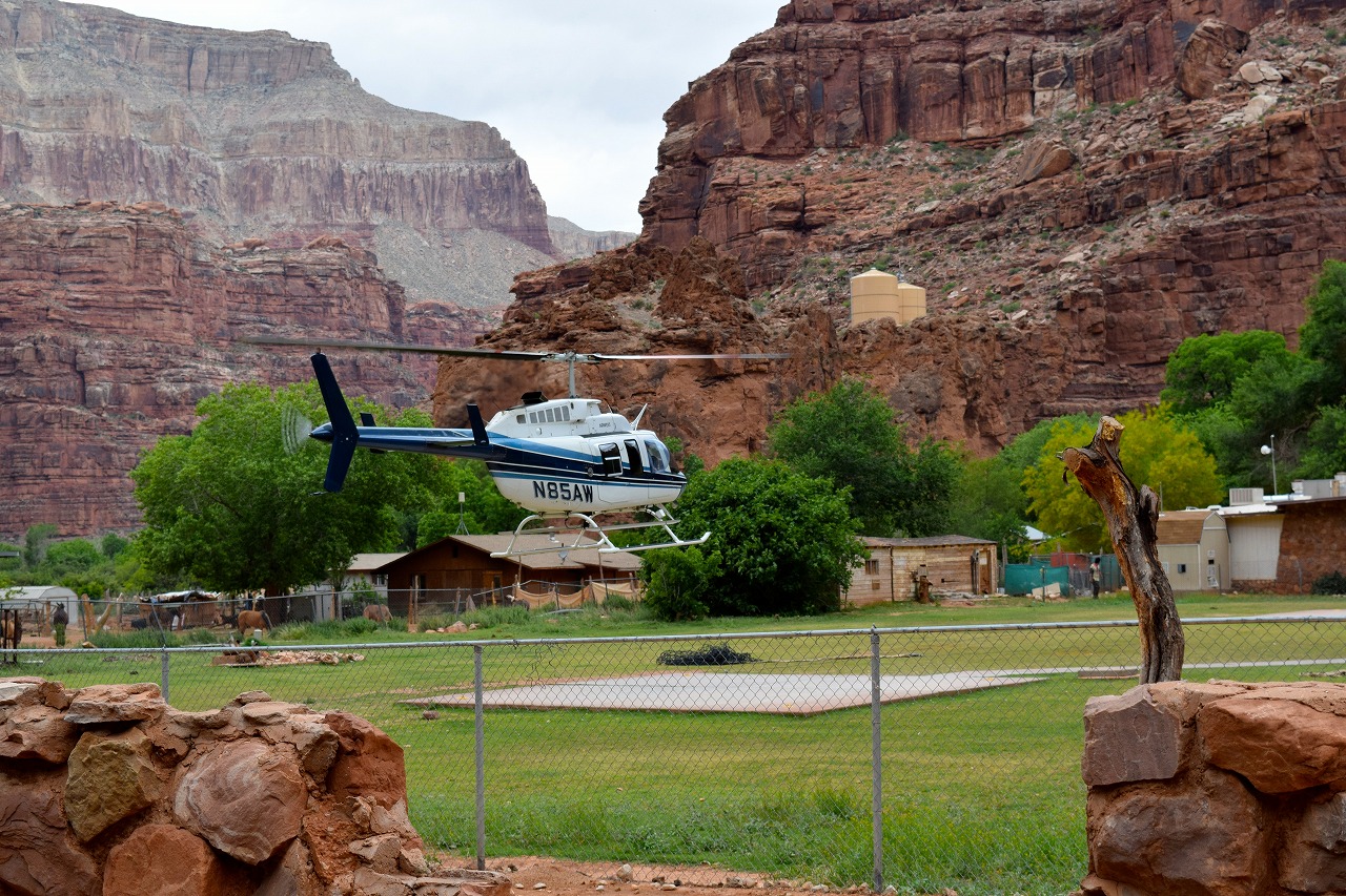
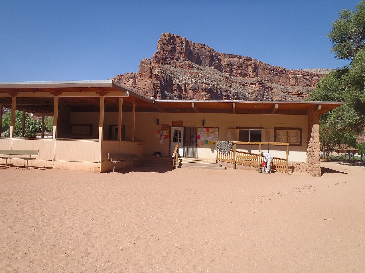
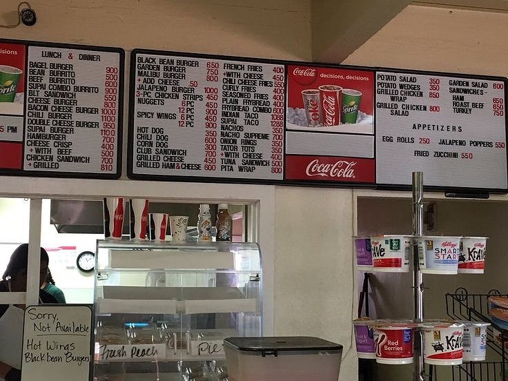
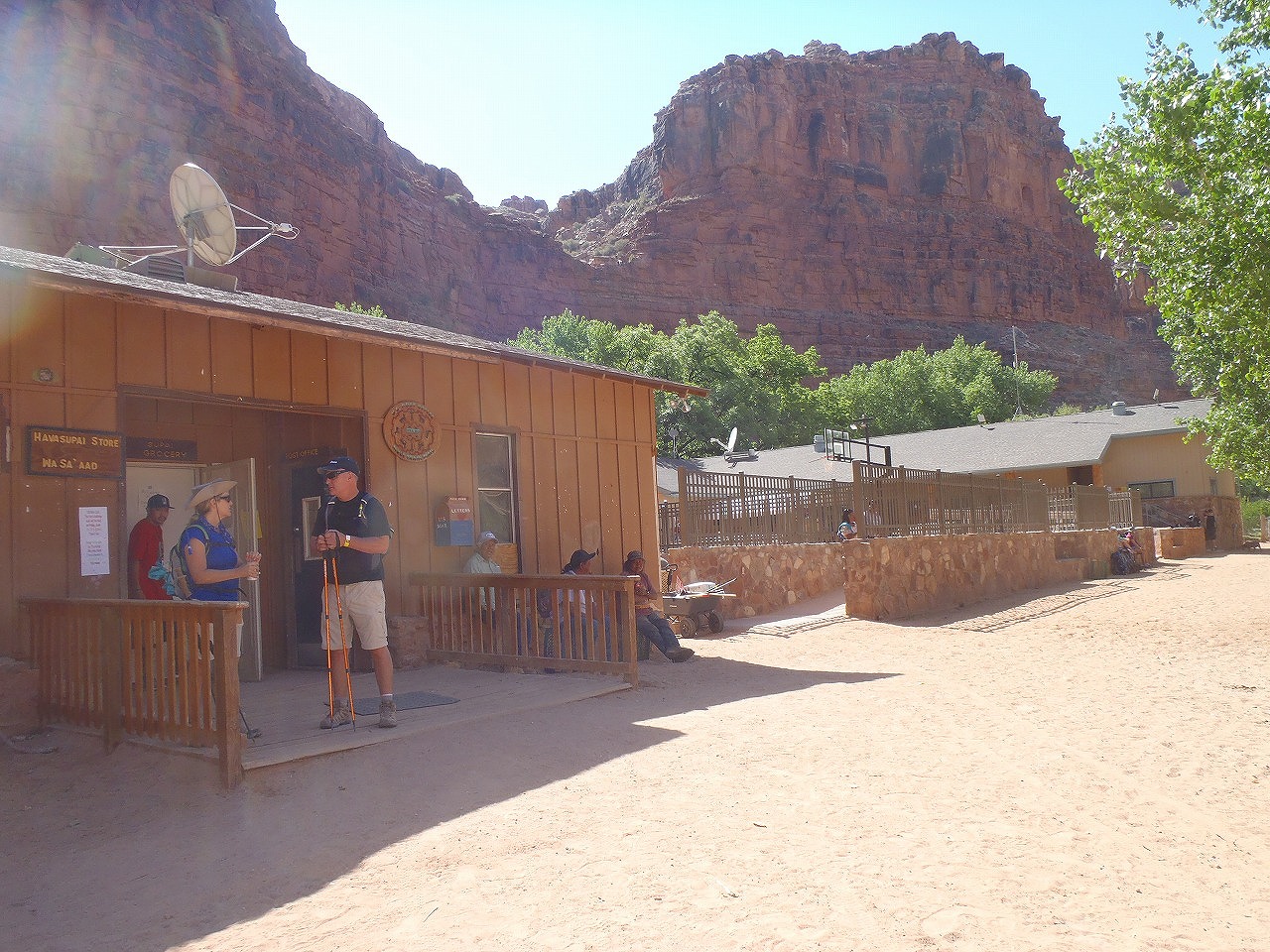
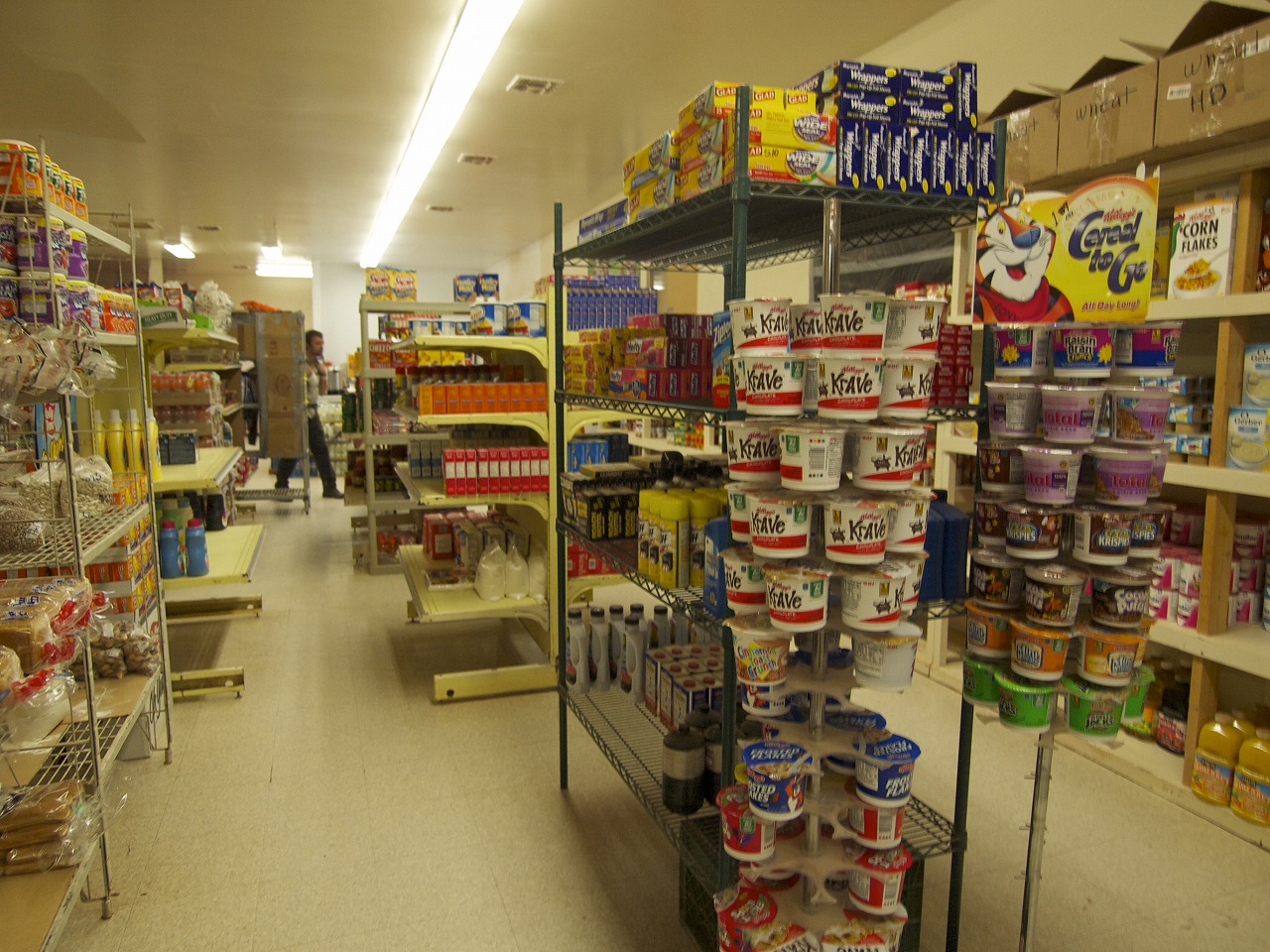
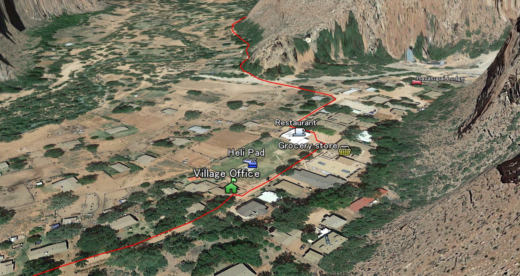 In few minutes, you will see the tourist office (green building) on your LEFT. You have to check in at the office to recieve the permit. Also, you can get the water at the out side of the office. (You may want to fill your bottle up at here when you hike out) There is a big helipad by the tourist office. All the fly in/out hikers/packs gets here. After you passed the helipad, there is a small restaurant on the left. They carry only easy food like burgers and sandwiches. Across from restaurant, there is an grocery store on the right side. This building really doesn't looks like grocery store, but they carry pretty much anything the local people needs...from Ice cream to AAA batteries. All the items in the store is little bit expensive, since everything cost the transportation fee. You will see Post office, school, Basketball court, church etc.... The Havasupai Lodge is located at the most end of the village (NE corner).
|
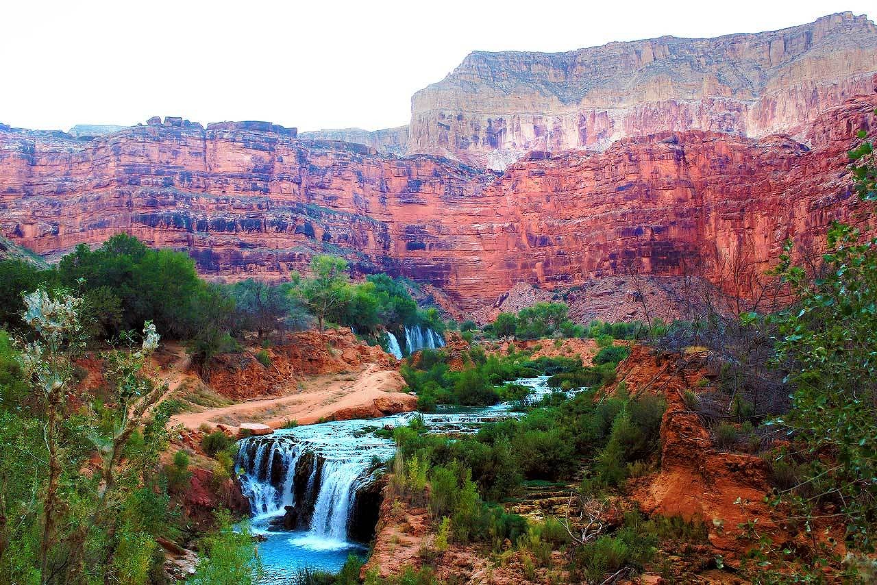
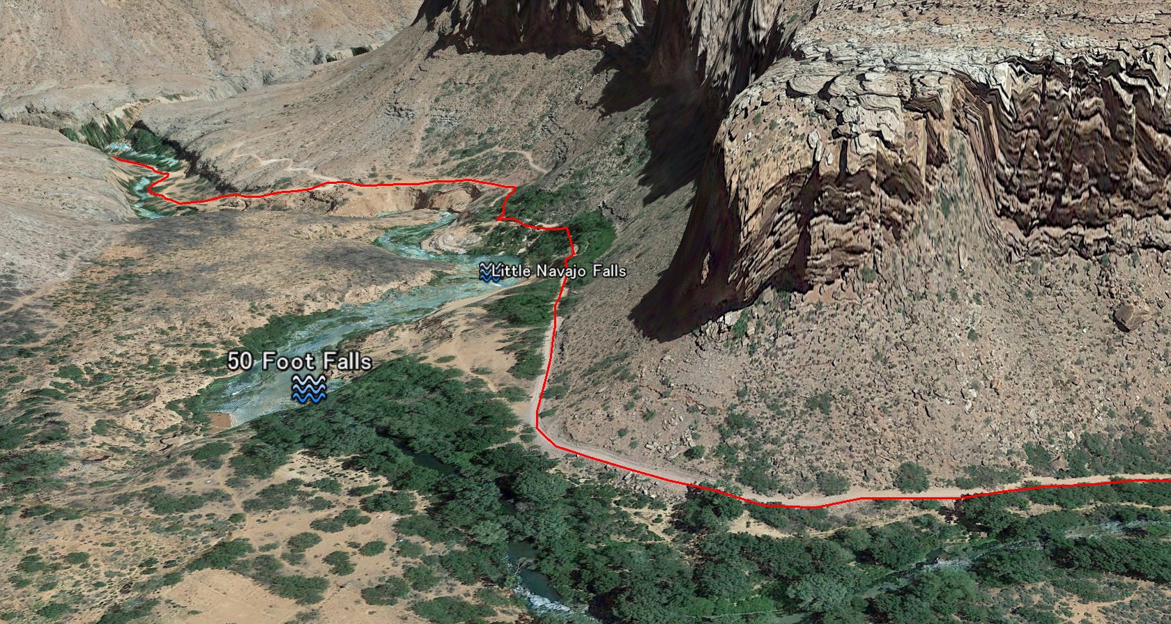 There are 2 more miles to the camp ground. On the way, you will see Little Navajo falls on the left side. Also, there is Fifty foot falls farther up to the left. You can barely see it from the trail. Its only 5-10 minutes walk to these falls.
|
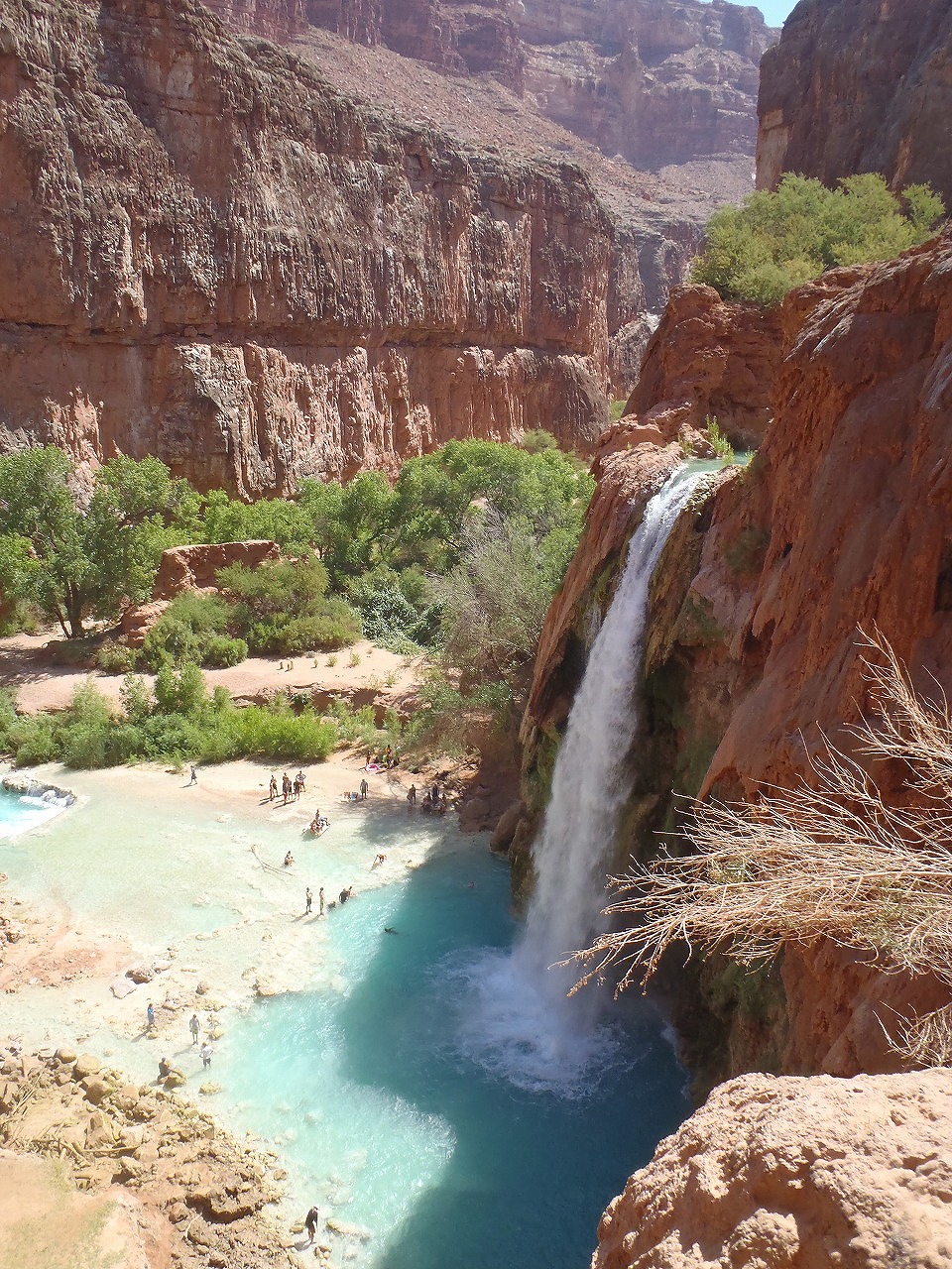
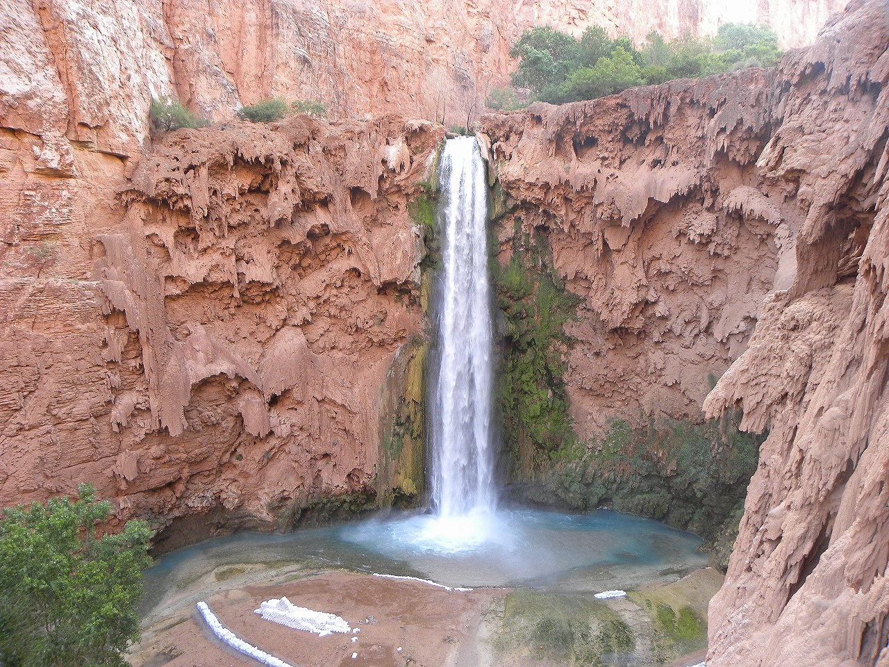
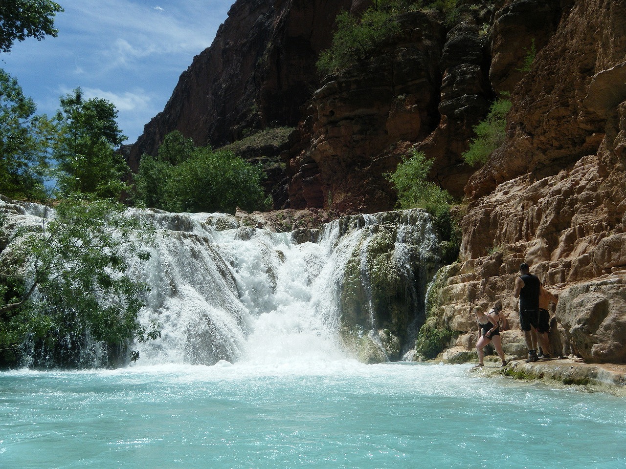
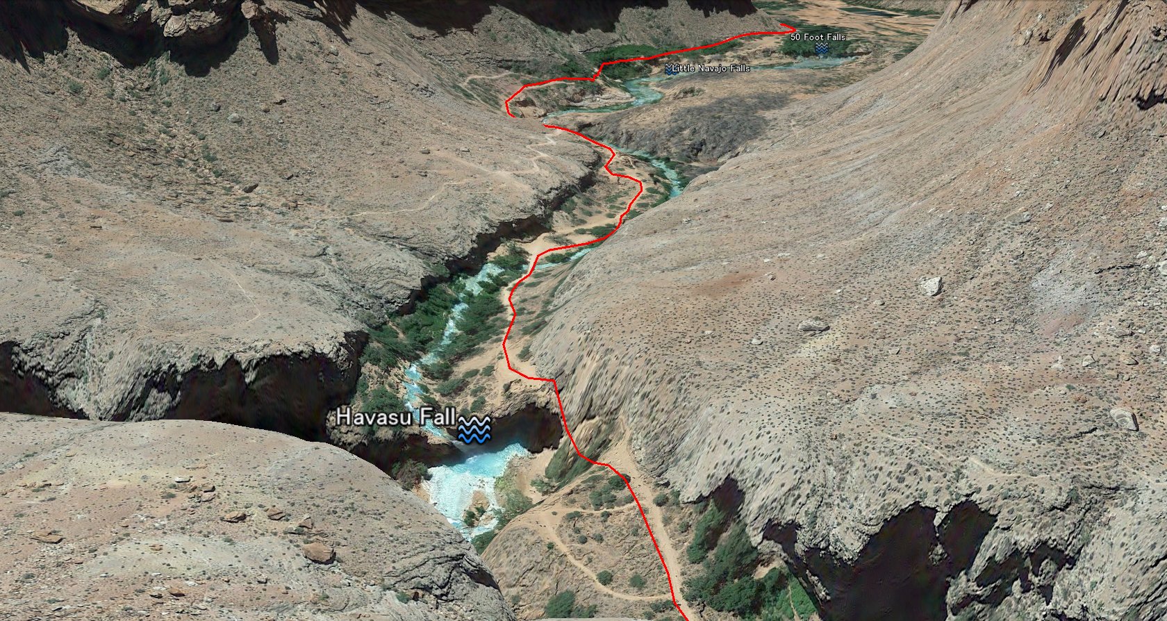 About 15 minutes after the Little Navajo Falls, there is the Havasu Falls. Havasu Falls is about 100 feet high and very beutiful. Trail goes down on the side of water falls.
|
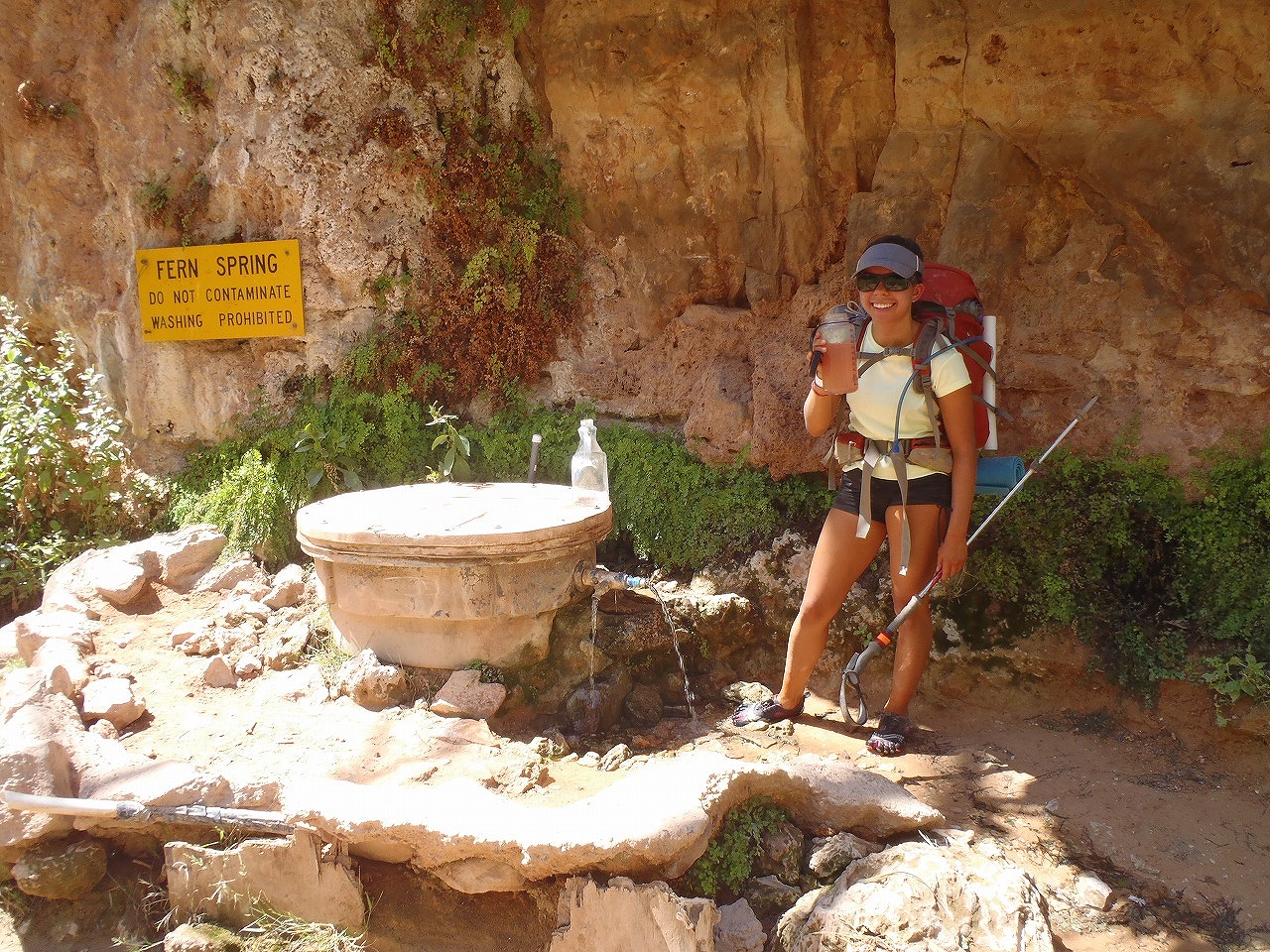
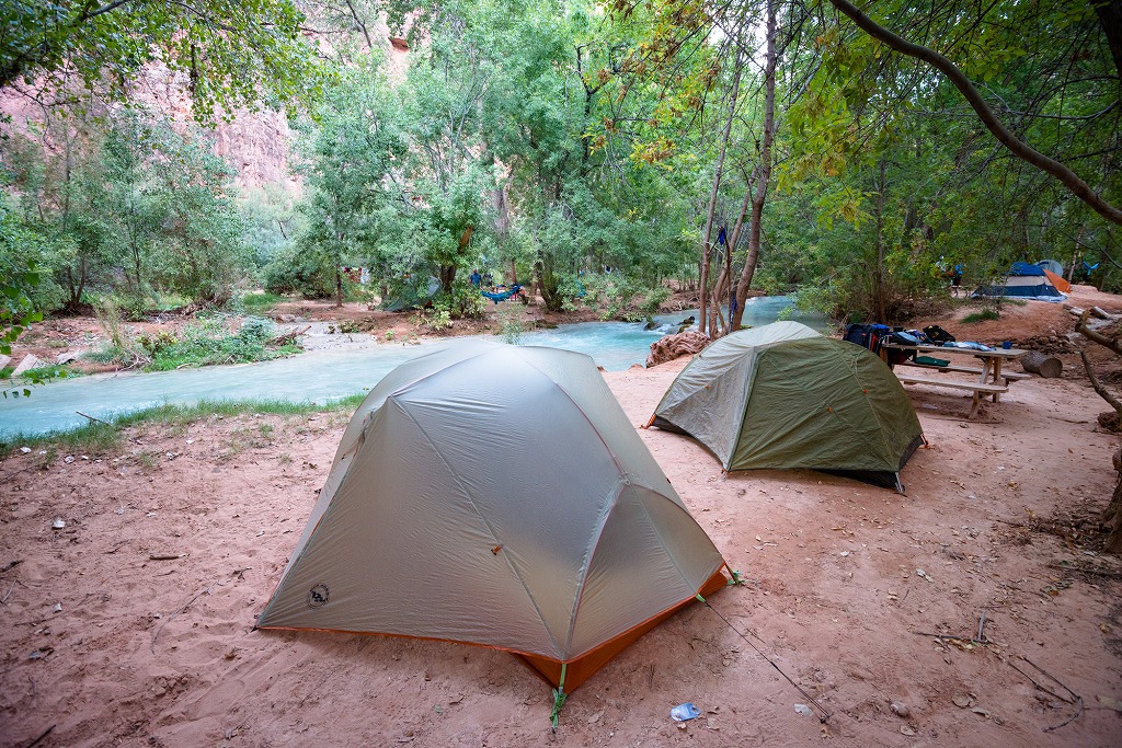
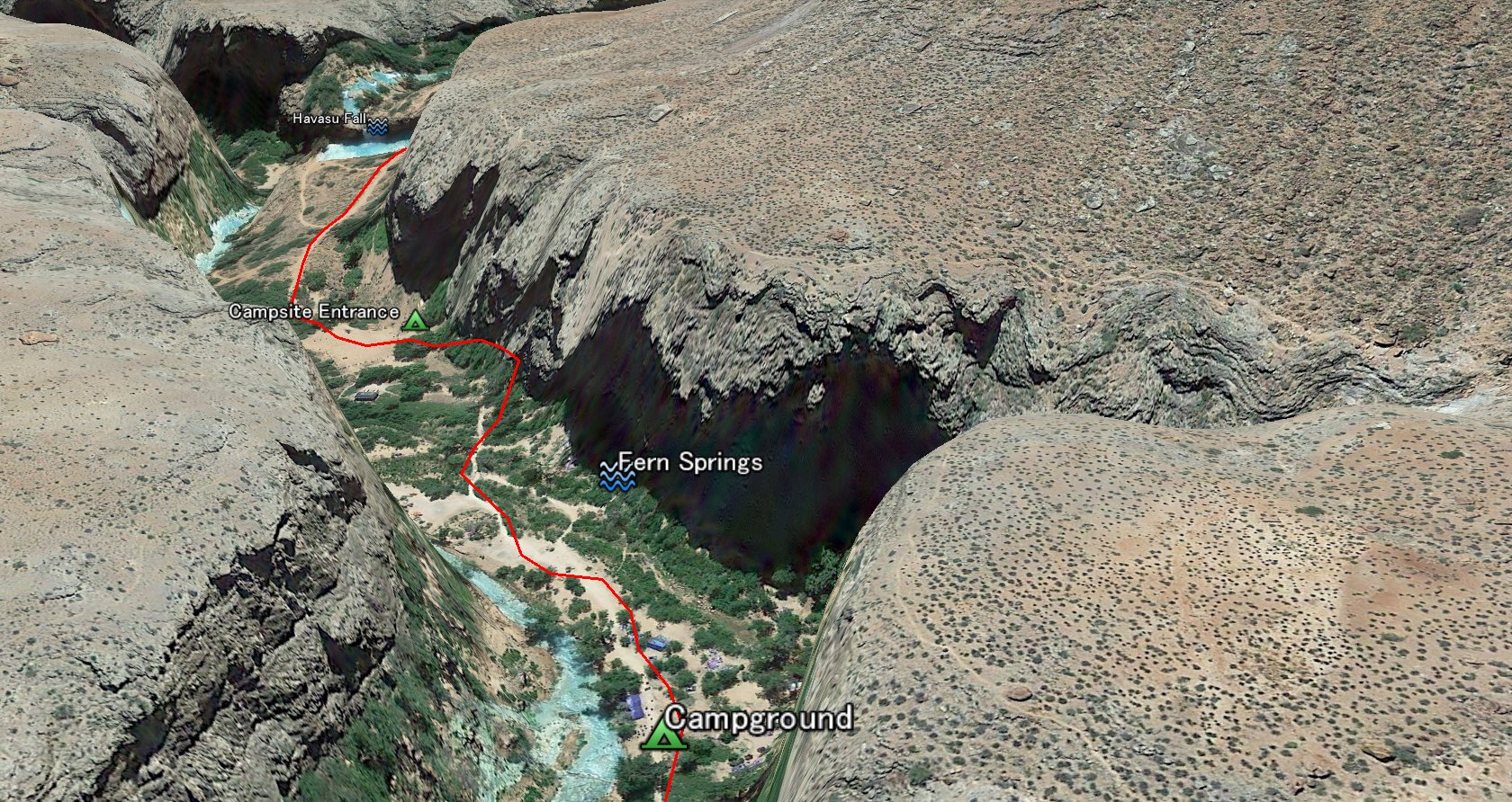 Campground entrance is only 5 minutes from the Havasu falls. There is a Fern Spring (natural spring) on the Left side about 3 minutes from the entrance. This campground is more than half mile long and 100 yard wide. The creek goes through the middle of the campground. You can find any spot for setting the tent. Ground is soft dart/sand most of the part. There are several restrooms in the campground.
|
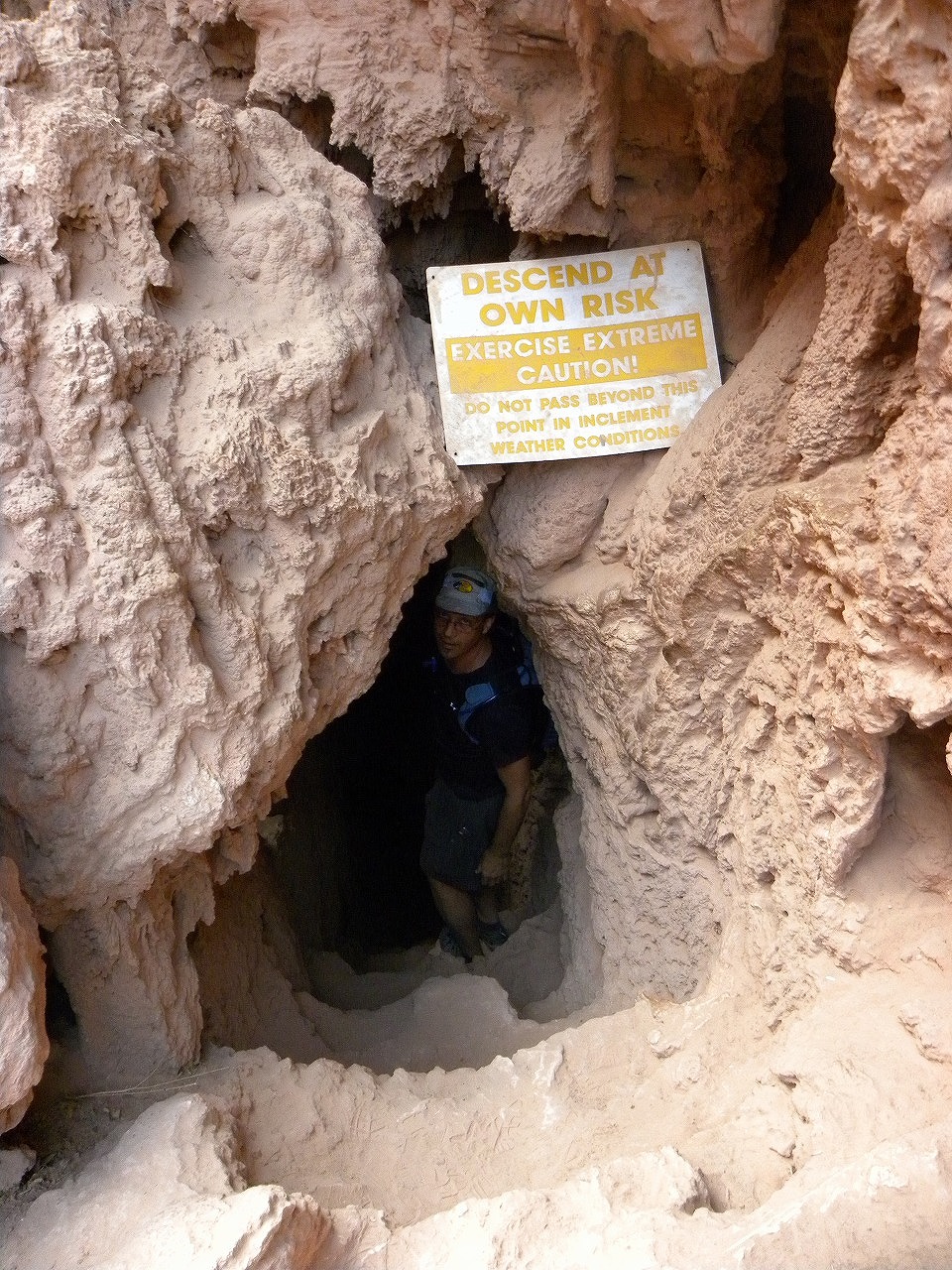
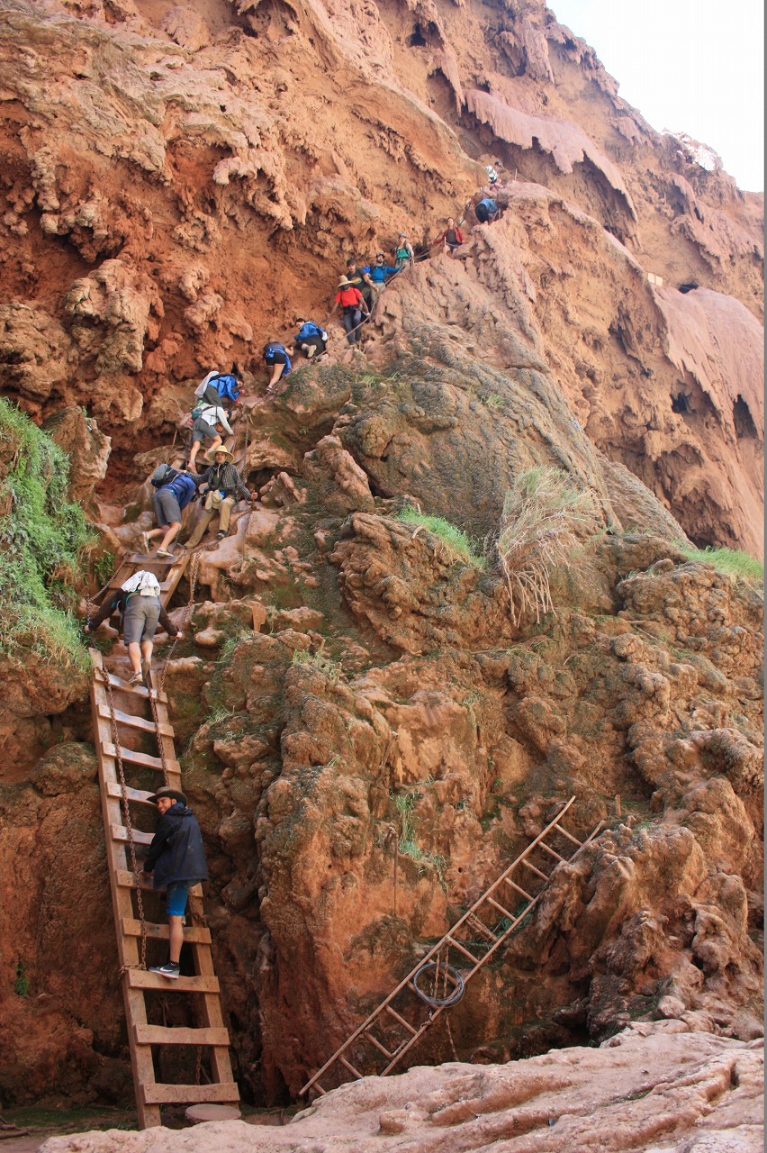
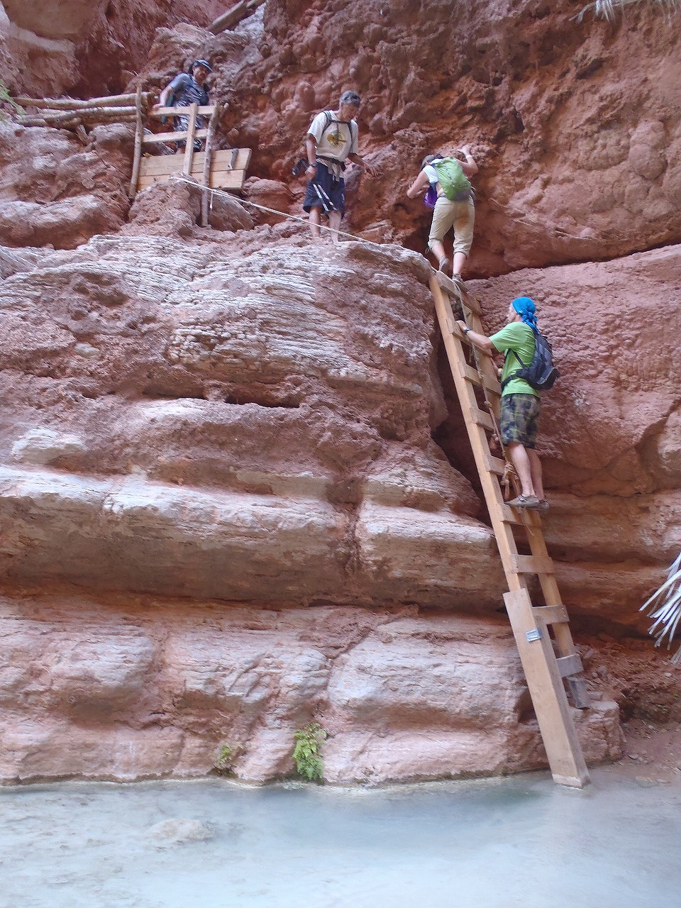
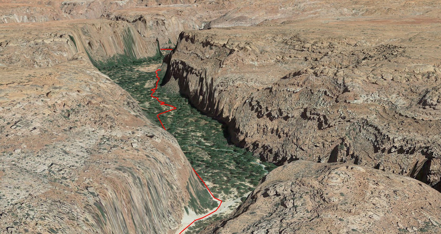
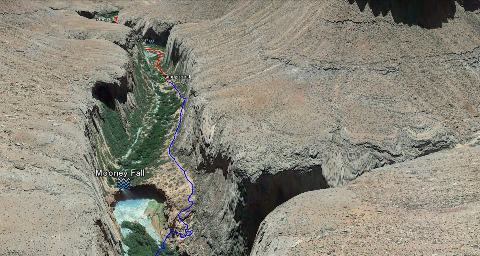 Moony Falls is only 5-10 minutes (about half mile) from the Campground. This is about 200 ft high waterfall and very gorgeous. For getting down the water fall, you have to take a very narrow and steep pass alongside the criff. At this section, there is chains and radders.
|
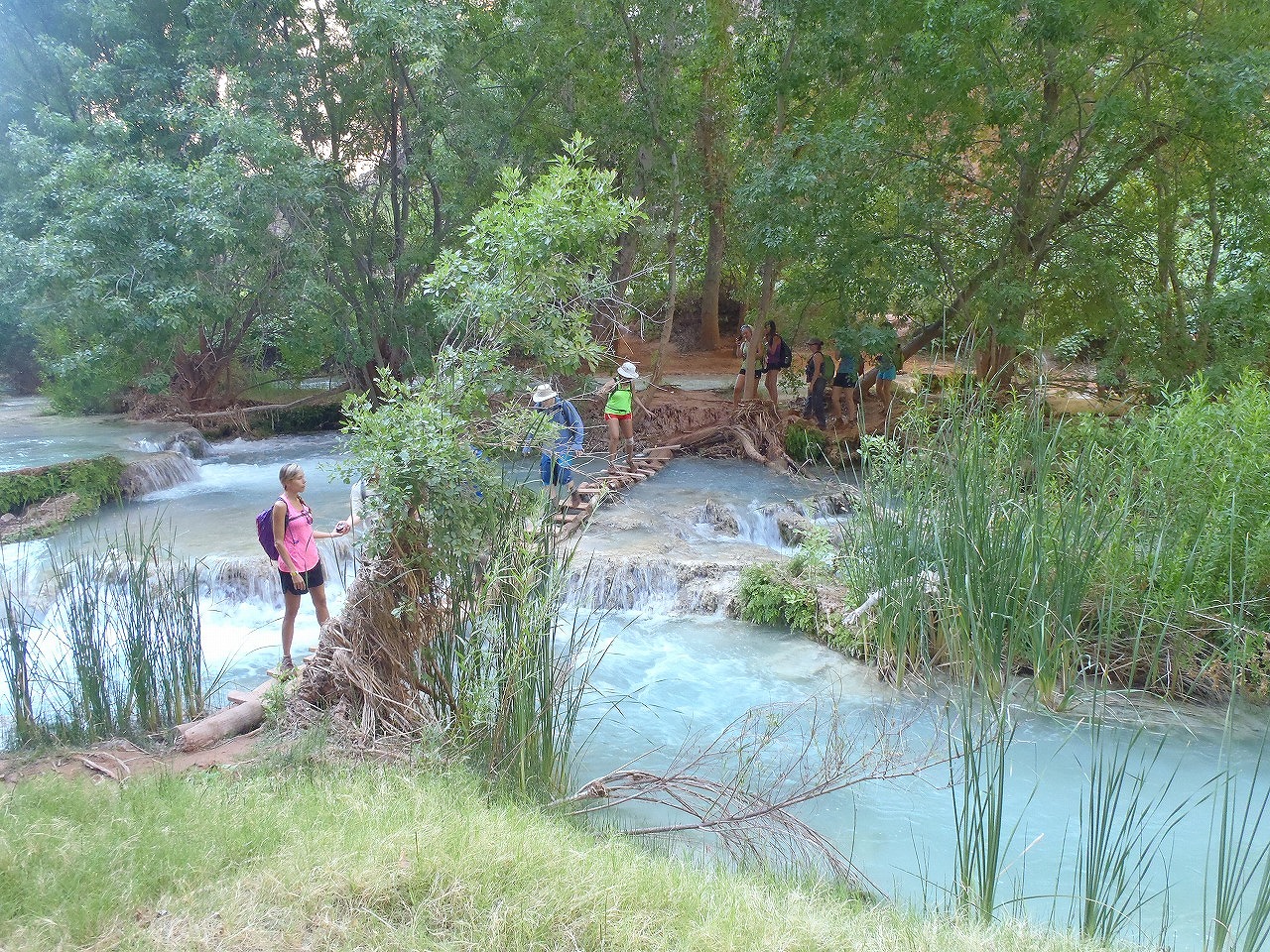
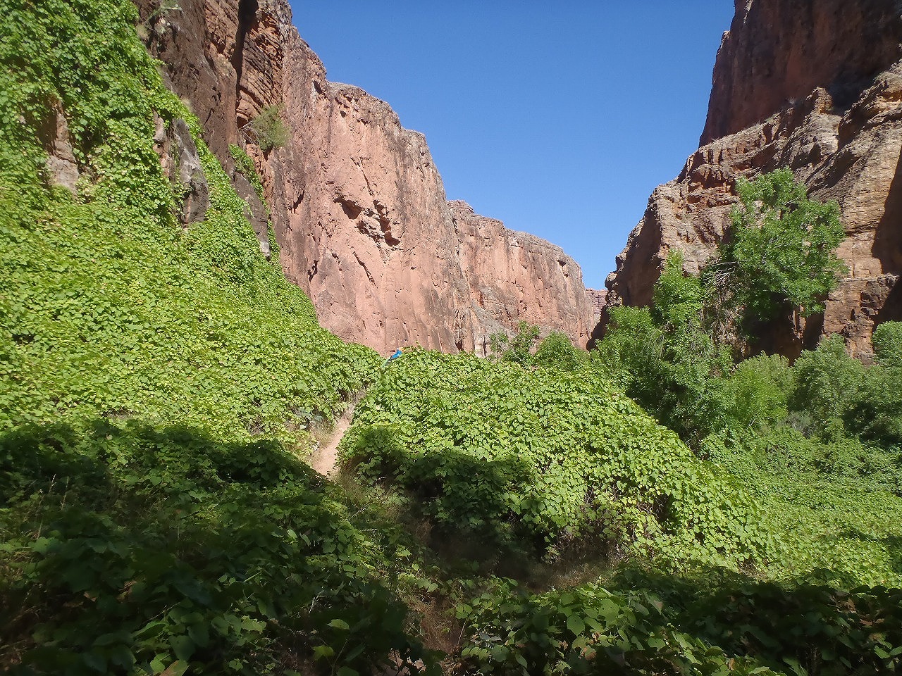
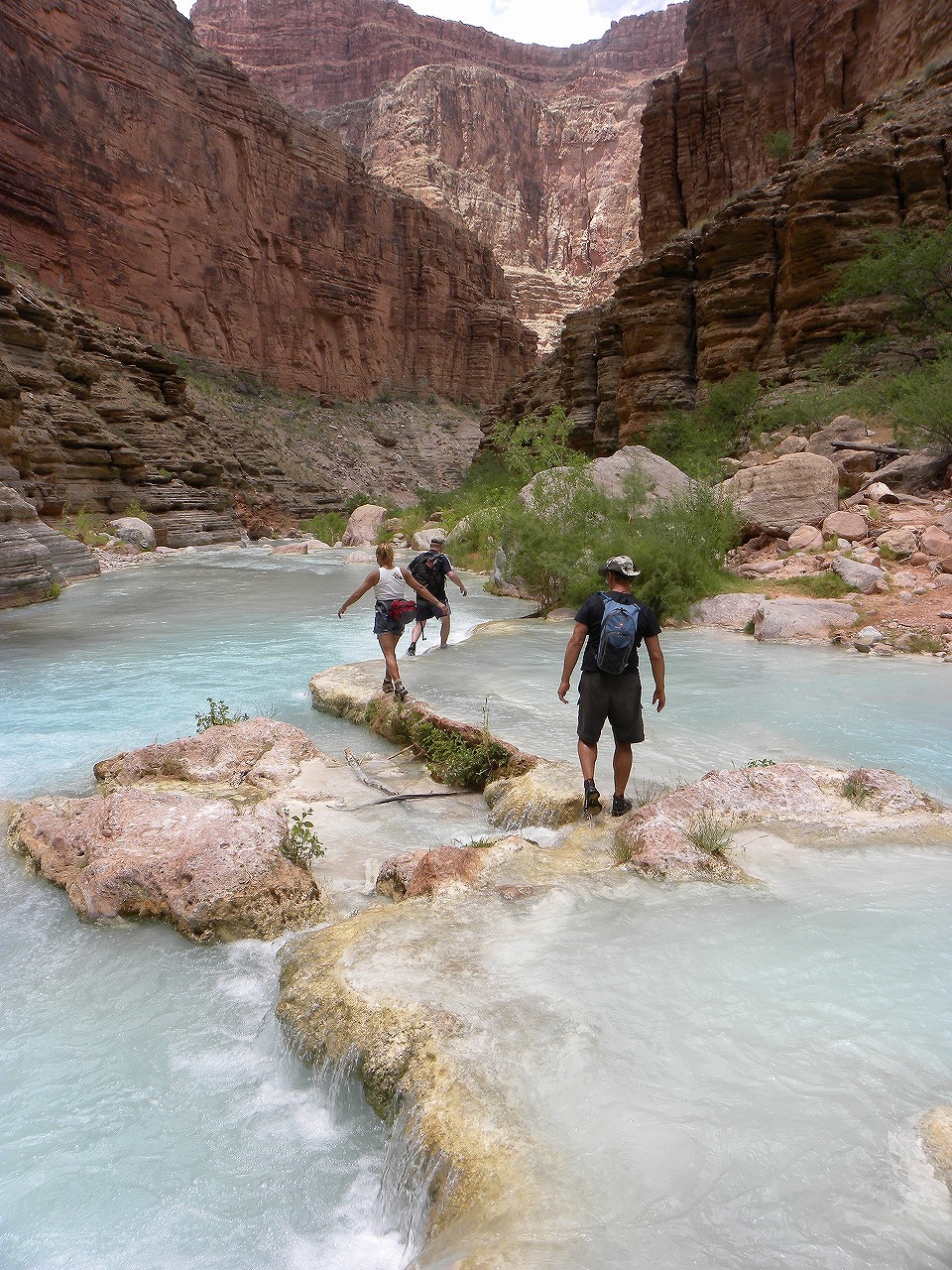
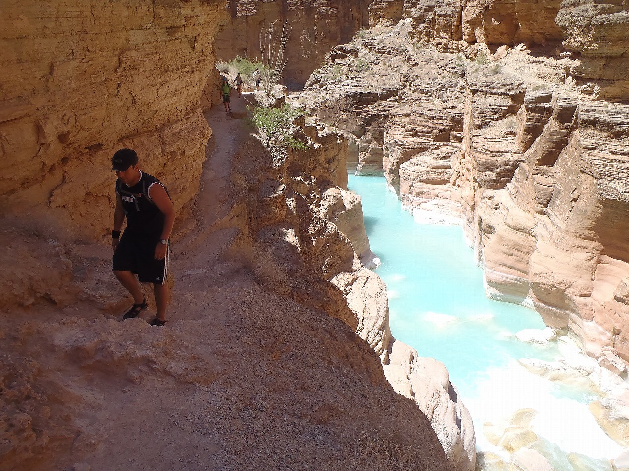
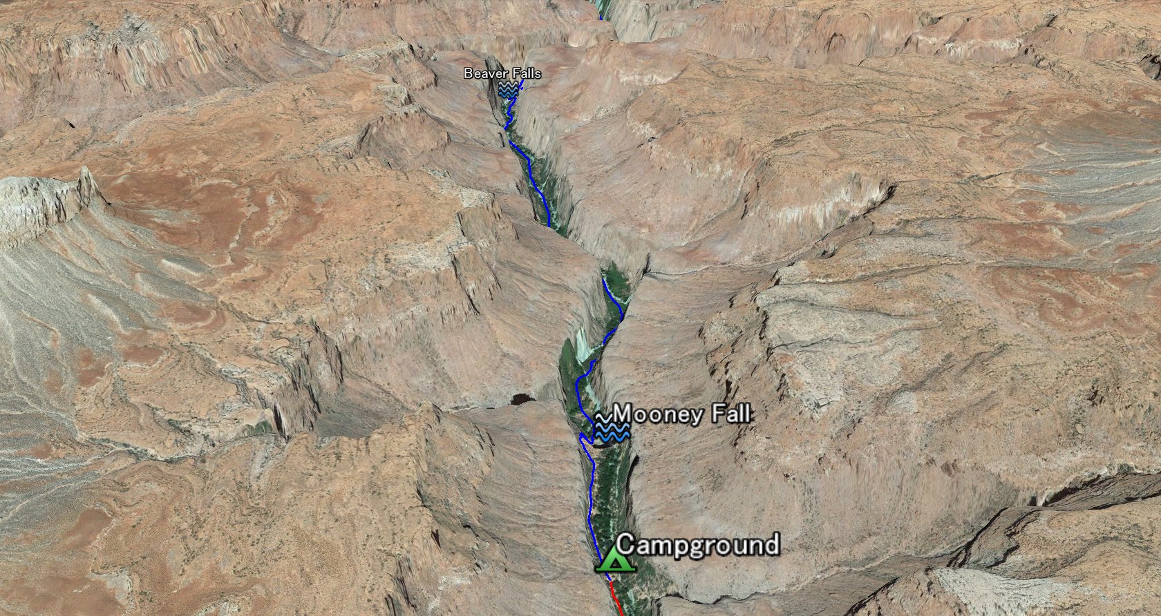 Beaver Falls is about 2.5 miles from the Campground. From the Moony Falls, follow the canyon for 2 miles down. There is a trails along the creek on either side. For couple of times, you have to walk across the creek to follow the trail. About a mile from the Mooney Falls, the trail goes through the deep vineyard. Beaver Falls are cascade falls. You can climb up the side of water fall to get to the top of falls to jump in.
|
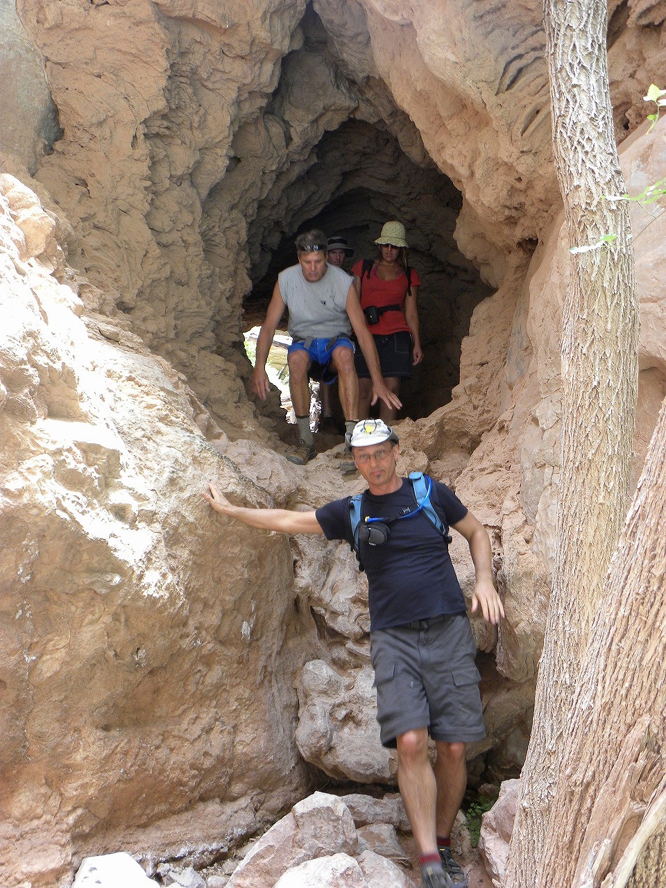
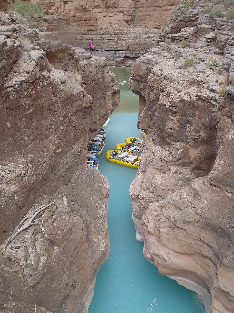
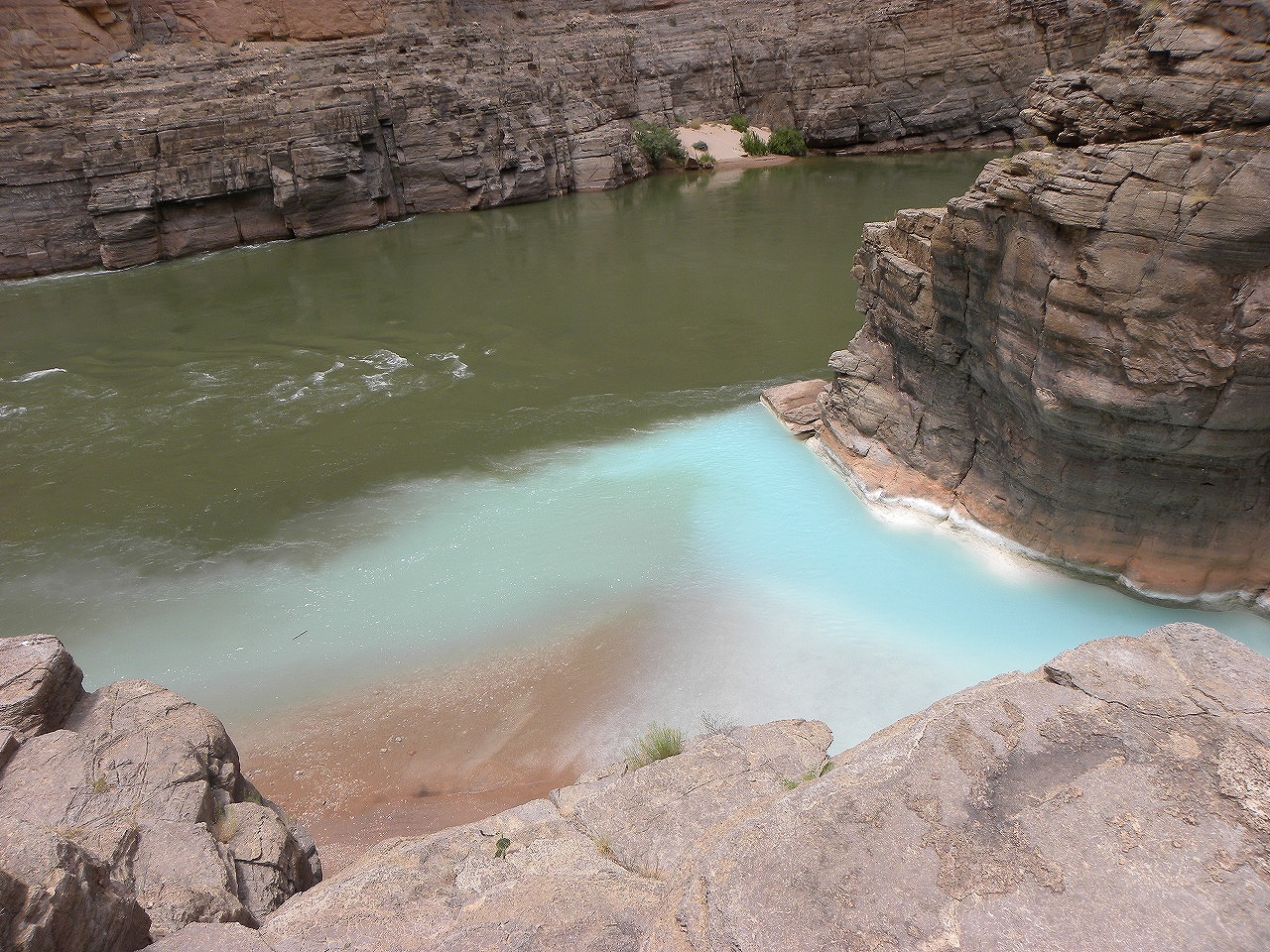
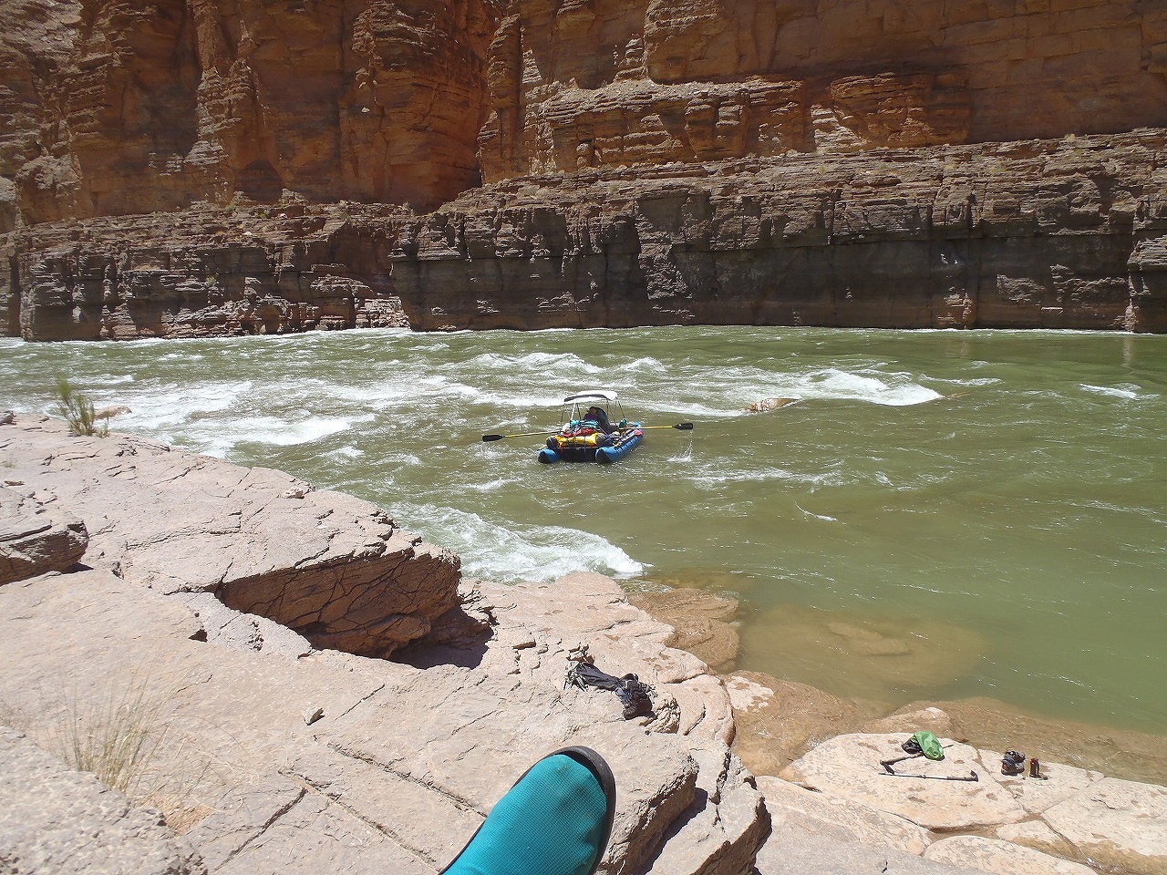
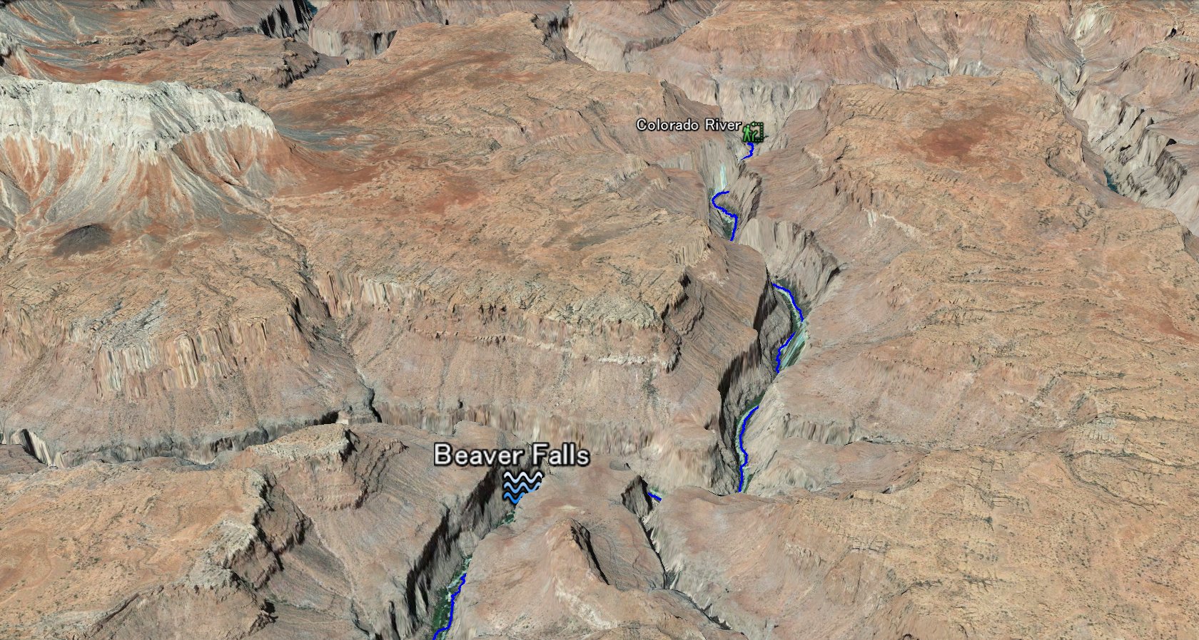 Colorado River is 6.5 miles from Campground. It is another 4 miles hike from Beaver falls. The trail gets little bit gets harder to follow. There are couple of easy class 3 sections.
|
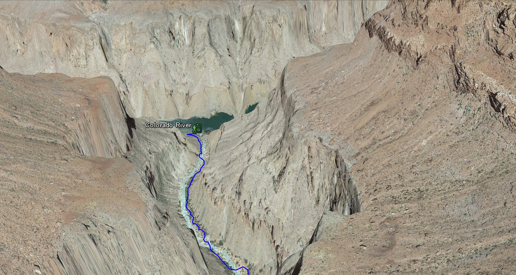 You will see lots of raft boat at the Colorado river junction. If you are lucky, you can see rafting boat at the Havasu rapids.
|