


Goldstrike Hot Springs
Location: Nevada, Lake Mead Area
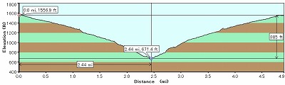
Elevation : 1,600 ft (trailhead) - 700 ft (Colorado River)
Overview...
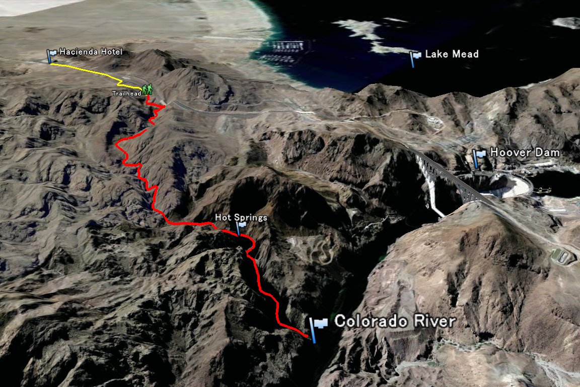
Goldstrike Hot Springs is one of the most famous hot springs for local hikers. Its located near Hoover Dam.

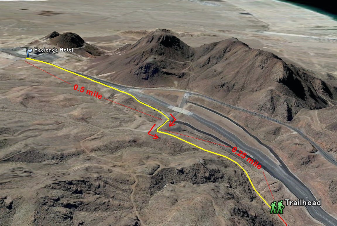
To get there, Take 95 Freeway South and pass the Boulder City. After pass the Hacienda Hotel (thats the last casino before the Hoover Dam), in half mile get off the Freeway. Make a right turn then left turn.
Road turn to dart road shortly after, but it is well maintaind that any car can drive. Dart road ends in 1/4 mile and there is a parking spot. This is the trailhead.

Route...
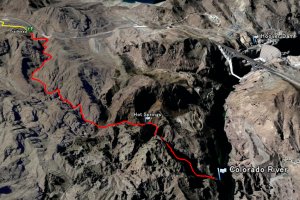
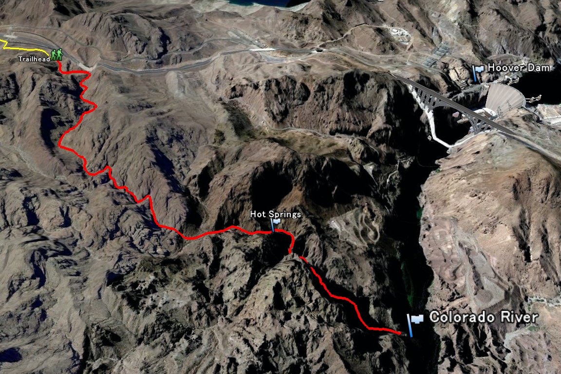
From the trailhead, hike follows the dry wash all the way to the Colorado River.
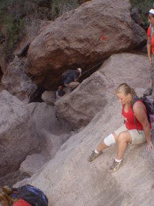
For first 1.4 mile is the easy hike. Then there is one big boulder choked in the canyon. You have to go around and walk down on the rock.
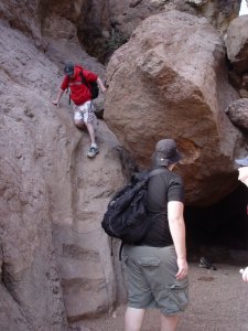
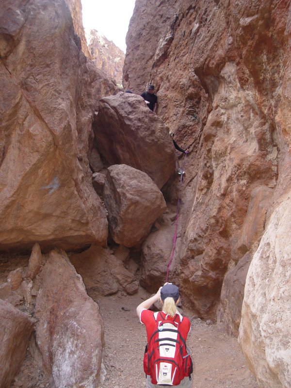
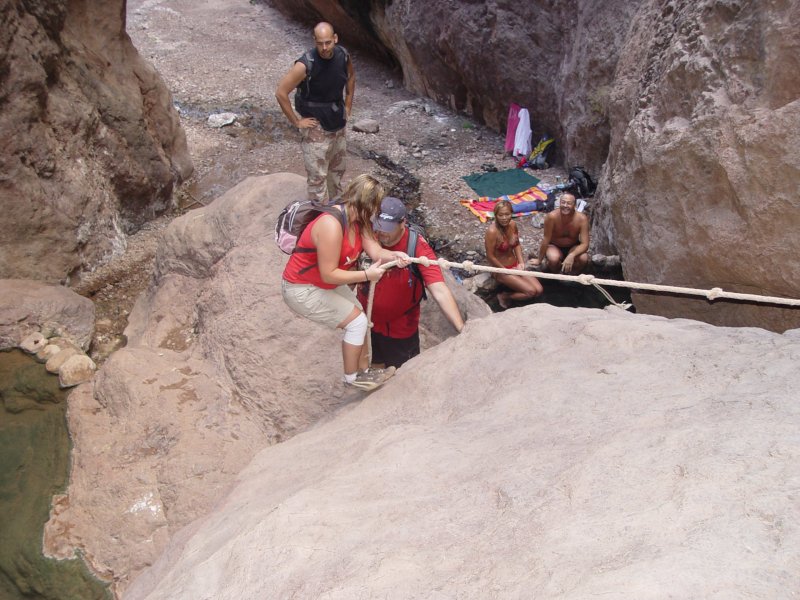
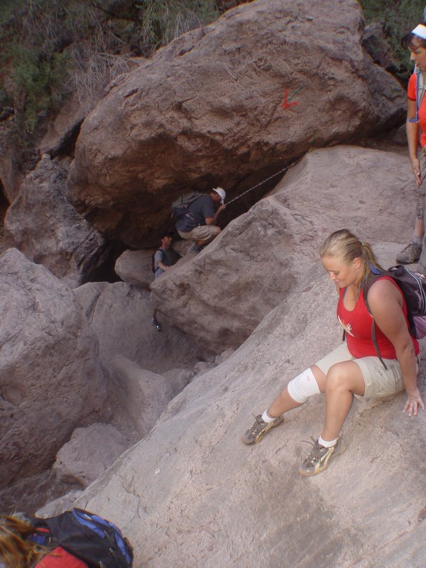
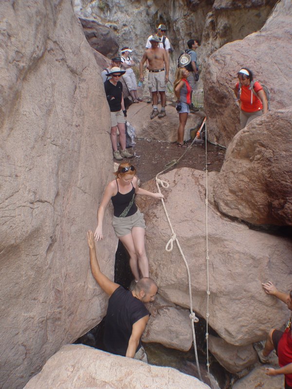
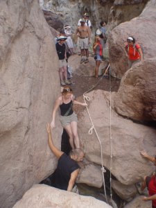
Canyon gets narrower. And you often go around the rocks and boulders. In half mile, there is one short rope section. It is about 15 ft and there is a fixed rope at most of the time. Even if there is no rope, its climbable, but recommend to bring about 30 ft rope if you are not confortable with class 3 scramble.

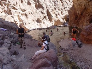
There is a big hot spring in the few minutes after the rope section.
If you want to keep continue to go all the way down to the Colorado River, its only half mile from there.
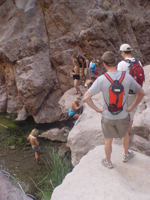
There are few short rope sections (those are all less then 15 ft) and many small hot springs.
You may cross or walk in the water for several times to get to the River. Water level is shallow and you may not get wet.
But, I recommend to bring water shoes or sandal if you have.


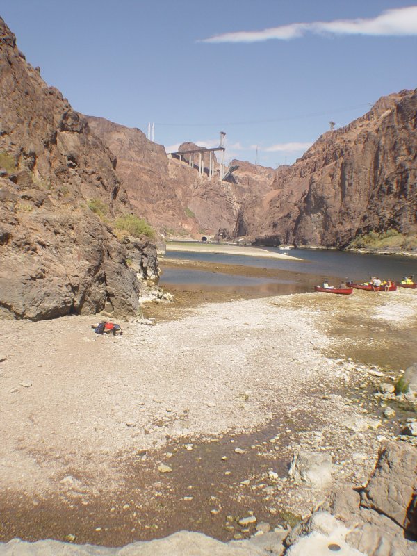
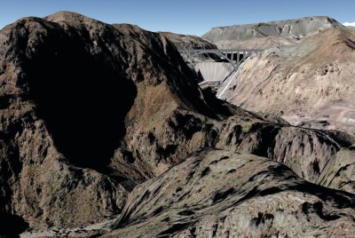
Once you get to the Colorado River, you can see the Hoover Dam bypass bridge on the left.

If water level of the Colorado River is low, you can walk up the river for few minutes to get to the Sauna Cave.
Stats:
Distance: 4 miles (round trip to the hot spring), 5 miles (round trip to the Colorado River)
Total Elevation gain/lose: about 650 ft (to the Hot Spring), about 900 feet (to the Colorado River)
Time: 2 hours (Hot Springs), 4 hours (Colorado River)
Difficulty: 2
Class: 3
Elevation Chart
My hike Album....
2009/05/03
2009/02/28
2008/10/04
Related Link...
Summit Post