June 11-14th 2010
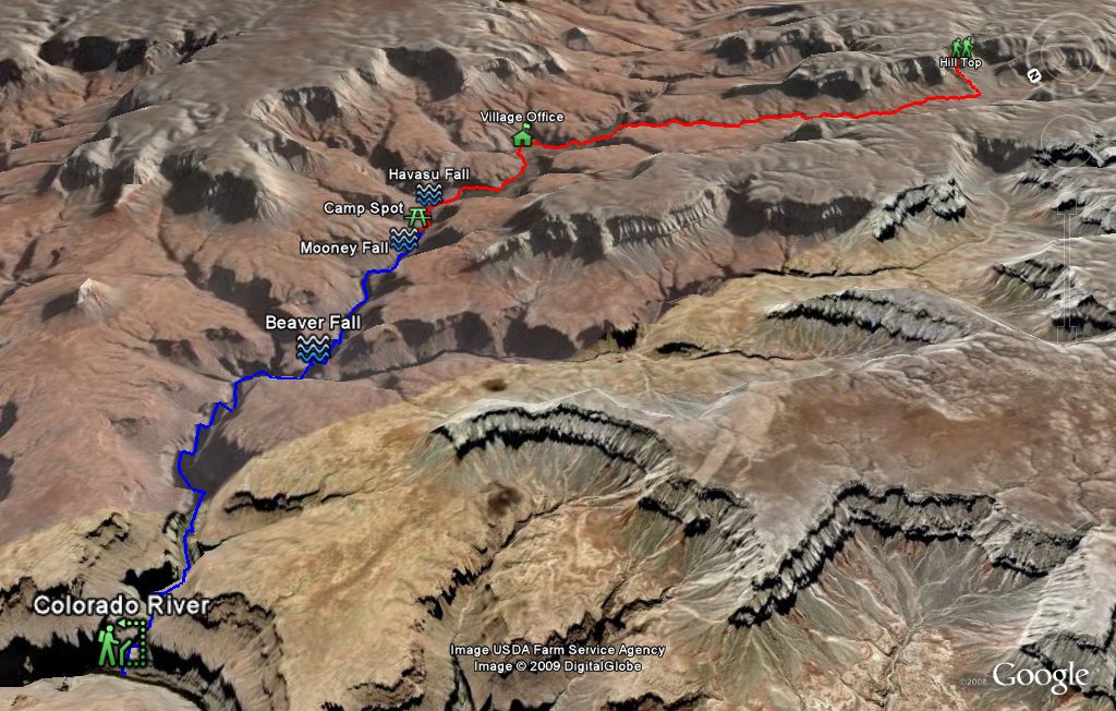 Entire 3D trail map |
 Hill Top to Bottom |
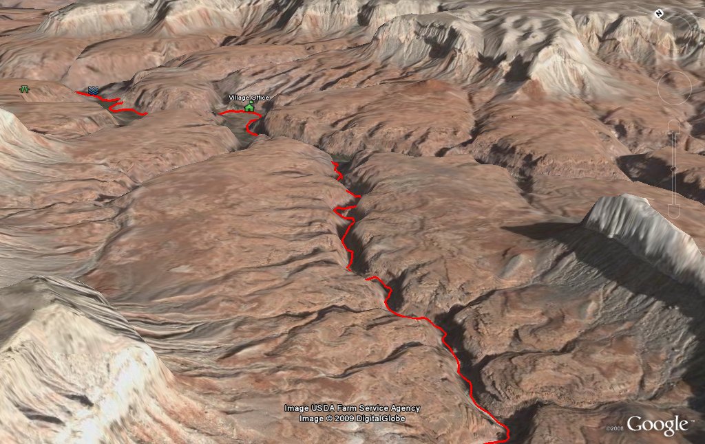 Towards Village |
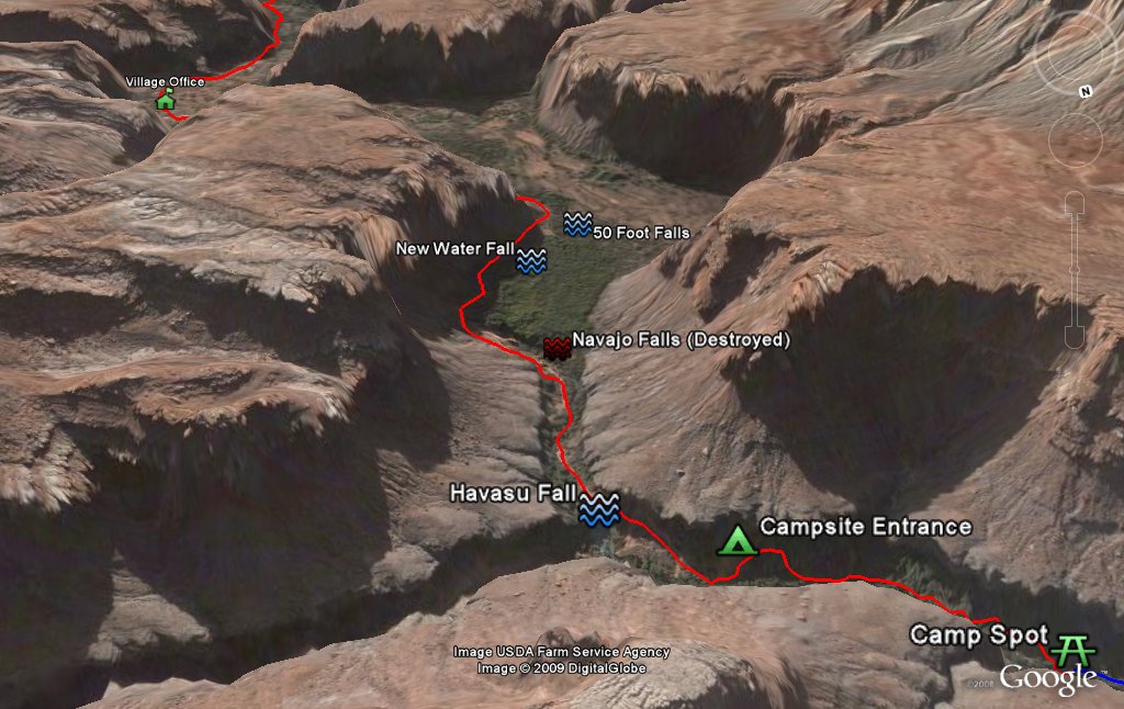 Village to Campsite |
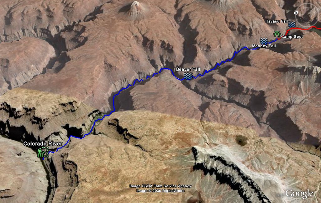 Colorado River Hike |
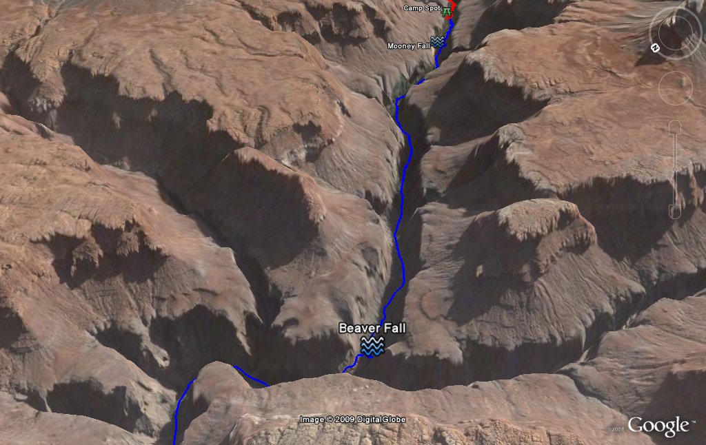 to the Beaver Falls |
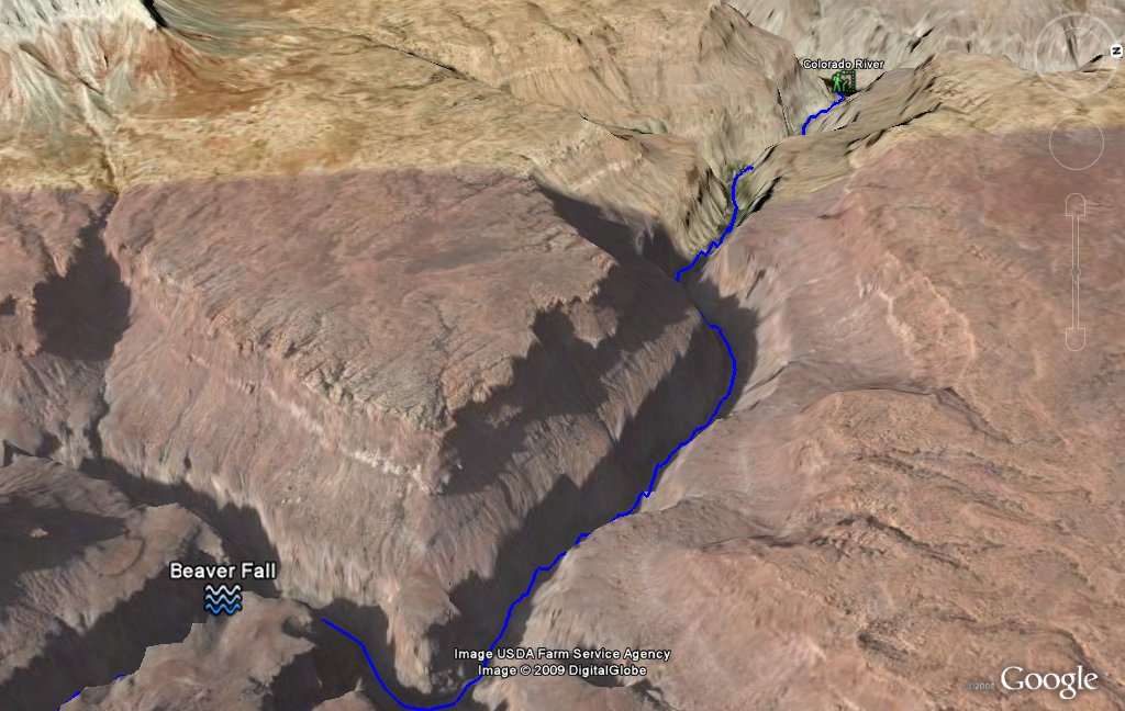 From the Beaver Falls |
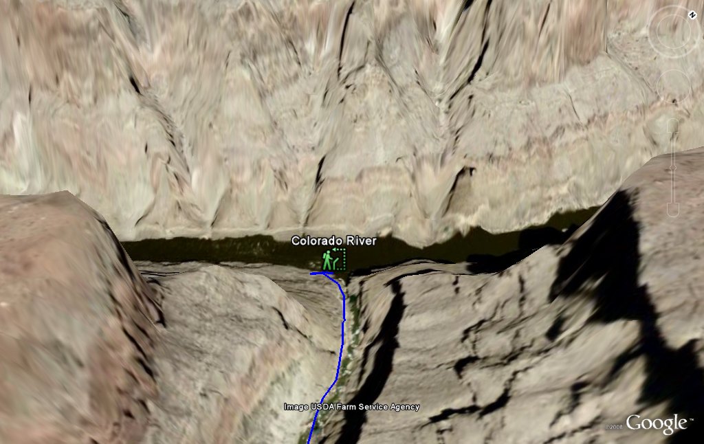 Colorado River |
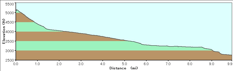 Elevation Chart (only Hilltop to Camp spot) |
| Click here to see 3D trail map on Google Earth |
| Showing 1-24 of 233 pictures | Next --> |

|
|

|

|
|

|
|
|
|

|

|
|
|

|

|
|

|
|
|
|
|
|

|
|
 |
 |